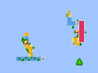
File:Sevii Islands Water Path Map.png
From Bulbapedia, the community-driven Pokémon encyclopedia.
Jump to navigationJump to search
Sevii_Islands_Water_Path_Map.png (192 × 144 pixels, file size: 3 KB, MIME type: image/png, looped, 8 frames, 2.8 s)
Note: Due to technical limitations, thumbnails of this file will not be animated.
| This file is from the Bulbagarden Archives. The description from its description page there is shown below. |
File history
Click on a date/time to view the file as it appeared at that time.
| Date/Time | Thumbnail | Dimensions | User | Comment | |
|---|---|---|---|---|---|
| current | 20:33, 22 September 2012 |  | 192 × 144 (3 KB) | Lady Ariel | {{anipng}} {{regionmap|Water Path|Sevii Islands|FRLG}} |
File usage
The following page uses this file:

