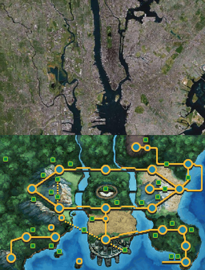
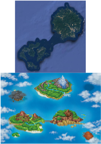
Pokémon world in relation to the real world
| Shortcut PKWorld |
| This article is a featured article. This means that it has been identified as one of the best articles produced on Bulbapedia. |

|
This article contains fan speculation. There is no solid evidence for or against some parts of this article. |
The designs of eight of the major Pokémon regions—Kanto, Johto, Hoenn, Sinnoh, Hisui, Unova, Kalos, Alola, and Galar—are strikingly similar in geography and demographics to regions in the real world, and they are sometimes even officially stated to be based on certain locations. The first four regions and Hisui region are based on smaller regions in Japan, Unova and Alola are based on parts of the United States, Kalos is based on France, and Galar is based on the United Kingdom. It is said the inspiration for Orre is Phoenix, Arizona.
Core regions
Kanto
The Kantō region of Japan (関東地方, Kantō-chihō, meaning "Region East to the Barrier", referring to the east of the Hakone checkpoint) is not only identical in name to Kanto in the Pokémon world, but is also very similar geographically; however, the western part of the game map corresponds to eastern Chūbu (中部地方, Chūbu-chihō, meaning "Central region", also called 中部日本, Chūbu-nihon, that means "Central Japan").
| Pokémon world | Specific location | Prefecture | Notes | ||
|---|---|---|---|---|---|
| Pallet Town | 下田市 | Shimoda City | 静岡県 | Shizuoka | Pallet Town is based on Satoshi Tajiri's hometown Machida City during his boyhood. |
| Route 1 | 伊豆半島 | Izu Peninsula | 静岡県 | Shizuoka | A peninsula that connects Shimoda City to Mishima City. |
| Viridian City | 三島市 or 箱根町 | Mishima City or Hakone Town | 静岡県 or 神奈川県 | Shizuoka or Kanagawa | |
| Viridian Forest | 奥秩父山塊 | Okuchichibu Mountains | 埼玉県、山梨県、長野県 | Yamanashi, Saitama, and Nagano | |
| Route 2 | 秩父市 | Chichibu City | 埼玉県 | Saitama | Viridian Forest being inside Route 2 is a reference to its real world counterpart's name Okuchichibu - meaning "interior of Chichibu". |
| Pewter City | 前橋市 | Maebashi City | 群馬県 | Gunma | Maebashi rests at the foot of Mount Akagi. It is the capital city of the Gunma Prefecture. The famous Iwajuku archaeological site and the Iwajuku Museum are located in the city of Midori. |
| Route 3 | 桐生市 - 足利市 | Kiryū City - Ashikaga City | 群馬県, 栃木県 | Gunma, Tochigi | |
| Mt. Moon | 赤城山 | Mount Akagi | 群馬県 | Gunma | Mt. Akagi features a crater lake near the summit |
| Route 4 | 佐野市 - 栃木市 | Sano City - Tochigi City | 栃木県 | Tochigi | |
| Cerulean City | 宇都宮市 | Utsunomiya City | 栃木県 | Tochigi | Utsunomiya City is the capital city of the Tochigi Prefecture. |
| Cerulean Cave | 大谷資料館 or 足尾銅山 | Ōya History Museum - Subterranean Cave or Ashio Copper Mine | 栃木県 | Tochigi | Ōya History Museum used to be a quarry with a network of monumental underground chambers, and is located in Utsunomiya City. |
| Routes 24 & 25 | 日光国立公園, 那須塩原市 | Nikkō National Park and Nasushiobara City | 栃木県 | Tochigi | |
| Sea Cottage | 北茨城市 | Kitaibaraki City | 茨城県 | Ibaraki | It's known for Rokkakudō, a wooden retreat overlooking the sea along the Izura coast. |
| Route 9 | 水戸線 | Mito Line | 栃木県, 茨城県 | Tochigi, Ibaraki | Specifically, from Sakuragawa City to Ishioka City. |
| Rock Tunnel | 筑波山 | Mount Tsukuba | 茨城県 | Ibaraki | A non-volcanic mountain renowned for its beautiful granite. |
| Route 6 | 京葉線 | Keiyō Line | 千葉県 | Chiba | |
| Vermilion City | 横浜市, 横須賀市, 千葉市 | A hybrid of Yokohama City, Yokosuka City and Chiba City | 神奈川県, 千葉県 | Kanagawa, Chiba | Geographically, it is based on Chiba City (capital city of the Chiba Prefecture). However, Yokohama (capital city of the Kanagawa Prefecture) is the largest and luxurious seaport of the three. Yokosuka has a United State Navy base, a possible inspiration for Vermilion Gym and Lt. Surge as an "American" soldier. |
| Diglett's Cave | 加曽利貝塚 | Kasori Shell Mound | 千葉県 | Chiba | The largest known shell mound found in Japan which can be viewed in a tunnel. |
| Routes 11, 13, 14 & 15 | 外房線 | Sotobō Line | 千葉県 | Chiba | Route 11 is based on Midori-ku ward, Route 13 on Katsuura City, Route 14 on Kamogawa City (due to wind turbines), and Route 15 on Minamibōsō City. |
| Kanto Power Plant | 東海発電所 | Tōkai Nuclear Power Plant | 茨城県 | Ibaraki | The first commercial nuclear power plant in Japan. |
| Lavender Town | 牛久市 or 鹿嶋市 | Ushiku City | 茨城県 | Ibaraki | Geographically, it's more closer to be based on Kashima City. However, Ushiku City contains Ushiku Jyoen - a large scale graveyard that allows to bury passed away pets. It also contains a small animal park, where people can feed various animals. |
| Pokémon Tower | 牛久大仏 | Ushiku Daibutsu | 茨城県 | Ibaraki | The fifth tallest statue in the world, which is located near Ushiku Jyoen (a large scale graveyard). Could also be based on Kashima Shrine. |
| Route 8 | 京成東成田線 | Keisei Higashi-Narita Line | 千葉県 | Chiba | |
| Route 12 | 九十九里浜, 銚子市 | Kujūkuri Beach, Chōshi | 千葉県 | Chiba | Chōshi City has one of the largest fish catches in Japan. |
| Underground Path | 東京メトロ東西線 | Tokyo Metro Tozai Line | 東京都, 千葉県 | Tokyo, Chiba | |
| Route 7 | 新宿御苑 or 代々木公園 | Shinjuku Gyo-en or Yoyogi Park | 東京都 | Tokyo | Shinjuku Gyo-en is the largest garden park in Shinjuku. Part of it and Yoyogi Park are in Shibuya, a ward located between Setagaya and Shinjuku wards. |
| Celadon City | 多摩ニュータウン or 世田谷区 | Tama New Town or Setagaya | 東京都 | Tokyo | Tama New Town is the largest housing development in Japan, containing several retails and leisure complexes, indoor theme park (Sanrio Puroland) and hotels. Setagaya has the largest population of Tokyo's special wards. |
| Route 5 | さいたま市 | Saitama City | 埼玉県 | Saitama | |
| Saffron City | 東京都 (新宿区 and 千代田区) | Tokyo (Shinjuku and Chiyoda wards) | 東京都 | Tokyo | Shinjuku is a major commercial and administrative centre, housing the busiest railway station in the world. Chiyoda is an economical powerhouse of Tokyo, as well as all of Japan. Chiyoda is also the political center of Japan: the Imperial Palace, Prime Minister's Official Residence, the National Diet and the Supreme Court are located here. |
| Magnet Train station | 新宿駅 or 新大阪駅 | Shinjuku Station or Shin-Ōsaka Station | 東京都 | Tokyo | Shinjuku Station is world's busiest train station. The Tōkaidō Shinkansen bullet train line in Shin-Ōsaka Station runs from Tokyo to Osaka. |
| Fuchsia City | 館山市 or 富津市 | Futtsu City or Tateyama City | 千葉県 | Chiba | Futtsu City is located closer to the Quasi-National Park, while Tateyama City contains lots of historic buildings. |
| Kanto Safari Zone | 富士箱根伊豆国立公園 (マザー牧場) | Minami Bōsō Quasi-National Park (specifically Mother Farm) | 千葉県 | Chiba | Mother Farm is an animal theme park located in the Futtsu part of Quasi-National Park. Established in 1962, it's famous for its sheep shows and guests can interreact with various domesticated animals. |
| Route 16 | 鎌倉市 - 平塚市 | Kamakura City - Hiratsuka City | 神奈川県 | Kanagawa | |
| Cycling Road | 東京湾アクアライン | Tokyo Bay Aqua-Line | 神奈川県、千葉県 | Kanagawa and Chiba | It connects Kawasaki City and Kisarazu City over Tokyo Bay. It was under construction when Pokémon Red and Green were released. |
| Seafoam Islands | 江の島 | Enoshima | 神奈川県 | Kanagawa | A small offshore island. Home to the Iwaya Caves. |
| Water Routes 19, 20, & 21 | 相模湾 | Sagami Bay | 神奈川県 | Kanagawa | Many small islands are scattered around this bay. |
| Cinnabar Island | 伊豆大島 | Izu-Ōshima | 東京都 | Tokyo | Oshima is famous for Mount Mihara, an active volcano. |
| Route 22 | 富士箱根伊豆国立公園 | Fuji-Hakone-Izu National Park | 神奈川県, 静岡県, 山梨県 and 東京都 | Kanagawa, Shizuoka, Yamanashi and Tokyo | |
| Indigo Plateau | 埼玉県, 安中市 or 秩父多摩甲斐国立公園 | Northwestern Saitama, Annaka City or Chichibu Tama Kai National Park | 群馬県, 長野県, 山梨県 and 東京都 | Saitama, Gunma, Nagano, Yamanashi and Tokyo | Due to the confusing nature of the Kanto's map between Gen 1/3 and Gen 2/4, it's hard to pint-point the exact location. It's also possible the national park is the basis for Route 23 and Victory Road. |
| Route 28 | 山梨県 | Yamanashi Prefecture | 山梨県 | Yamanashi | Mt. Fuji is located here. Could possibly also based on Fujinomiya City. |
| Route 26 | 富士市 - 静岡市 | Fuji City - Shizuoka City | 静岡県 | Shizuoka | |
| Route 27 | 駿河湾 | Suruga Bay | 静岡県 | Shizuoka | Both Shiraito Falls and Otodome Falls, the real world Tohjo Falls, are located close to the bay. Two waterfalls separated by a mere 600 feet, located southwest of Mount Fuji. |
Sevii Islands
The Sevii Islands are based on two archipelagos off the coast of Tokyo: the Izu Islands (伊豆諸島, Izu-shoto, meaning "Izu Archipelago") and the Bonin Islands (小笠原諸島, Ogasawara-shoto, meaning "Ogasawara Archipelago"), both archipelagos are administered by the Tokyo Metropolis (under Japanese law, the prefecture of Tokyo is designated as a to (都), translated as metropolis)
Johto
In Japan, the Kantō region is often contrasted with the Kansai region (関西地方, Kansai-chihō, meaning "Region West to the Tollgate", referring to the regions west to the Osaka Tollgate), also known as Kinki region (近畿地方, Kinki-chihō, meaning "Region Near the Capital", referring to the cities of Nara and Kyoto, Japan former capital cities), which like Johto is to the west. However, Johto is geographically more similar to the Kansai region and the western Chūbu region combined, as well as a small part of eastern Shikoku region (四国地方 Shikoku-chihō, meaning "Region of the Four Provinces", referring to the four historical provinces that made up the island).
| Pokémon world | Specific location | Prefecture | Notes | ||
|---|---|---|---|---|---|
| Mt. Silver | 富士山 | Mount Fuji | 静岡県 and 山梨県 | Shizuoka and Yamanashi | The encounter with Red at Mt. Silver may be a reference to Kuninotokotachi. Waiting atop Mt. Silver as the series’ highest-level Trainer opponent, Red was the player character with humble beginnings from the first Pokémon games; Kuninotokotachi is said to be the first Japanese deity, born of something resembling a reed following the creation of heaven and earth, who resides atop Mt. Fuji. |
| New Bark Town | 静岡市 and 浜松市 | Hamamatsu City | 静岡県 | Shizuoka | Could also be based on Shizuoka City (capital city of the Shizuoka Prefecture), due to wind turbines added to New Bark Town in HGSS. At the same time construction was completed on a small wind-farm in Shizuoka City. |
| Route 29 | 岡崎平野 | Okazaki Plain | 愛知県 | Aichi | |
| Cherrygrove City | 半田市 and 南知多町 | Handa City and Minamichita Town | 愛知県 | Aichi | Both residences are located in Chita Peninsula, which is famous for flower cultivation. Could possibly be based on Nagoya City, the capital city of the Aichi Prefecture. |
| Route 31 | 濃尾平野 | Nōbi Plain | 愛知県 | Aichi | |
| Violet City | 奈良市 | Nara City | 奈良県 | Nara | Home to many historic buildings and monuments, Nara is where Japan was founded as a state. It was the capital of Japan from 710 CE to 794 CE as the seat of the Emperor before the capital was moved to Kyoto. Currently is the capital city of the Nara Prefecture. |
| Sprout Tower | 興福寺 or 法隆寺 | Kōfuku-ji or Hōryū-ji | 奈良県 | Nara | A five-story pagoda, Kōfuku-ji is the second-largest pagoda in Japan, located on northeast of Nara City. Hōryū-ji is the oldest wooden building in the world. |
| Ruins of Alph | 明日香村 | Asuka Village | 奈良県 | Nara | There are many archaeological sites in Nara such as Ishibutai Kofun (石舞台古墳) and Takamatsuzuka Tomb (高松塚古墳). |
| Route 32 | 松阪市, 伊勢志摩 | Matsusaka City and Ise-Shima | 三重県 | Mie | Ise-Shima is famous for fresh seafood and pearl cultivation. |
| Union Cave | 青の洞窟(がまの口) | Blue Grotto (Gama-no-kuchi) | 三重県 | Mie | The Blue Grotto of Kumano is a small sea cave in Tategasaki, the largest columnar rock formation in Nigishima Bay. |
| Route 33 | 熊野市, 和歌山県 | Kumano City and Wakayama Prefecture | 三重県, 和歌山県 | Mie, Wakayama | |
| Azalea Town | みなべ町 | Minabe Village | 和歌山県 | Wakayama | Minabe is famous for its high-quality Japanese apricots, known as ubame, and high-quality charcoal, known as Binchōtan. |
| Slowpoke Well | 熊野本宮大社 | Kumano Hongū Taisha | 和歌山県 | Wakayama | A Shinto Shrine that was originally located on a sandbank by Kumano River. It was relocated to the mountain after being partially destroyed in the flood. The sandbank now contains the largest torii shrine gate in the world. |
| Ilex Forest | 熊野古道 | Kumano Kodō | 和歌山県 | Wakayama | The Kumano Kodō is a series of ancient pilgrimage routes spread across the old-growth forest that connects various sacred shrines that have been sites for centuries of ascetic worship of natural phenomenon and natural wonders. |
| Route 34 | 有田市 - 和歌山市 | Arida City - Wakayama City | 和歌山県 | Wakayama | |
| Goldenrod City | 大阪市 | Ōsaka City | 大阪府 | Ōsaka | Ōsaka is the largest and most populous city in the Kansai region, serving as a major hub and financial center in the country. It is also the capital city of the Urban Prefecture of Osaka. Osaka Prefecture is one of Japan's two "urban prefectures" using the designation fu (府) rather than the standard ken for prefectures, along with Kyoto Prefecture. |
| Goldenrod Radio Tower | 通天閣 | Tsūtenkaku | 大阪府 | Ōsaka | Tsūtenkaku is one of the most popular landmarks in Osaka. |
| Route 35 | 服部緑地 | Hattori Ryokuchi Park | 大阪府 | Ōsaka | A green space in Northern Osaka. Located close to the Expo Commemoration Park. |
| National Park | 明治の森箕面国定公園 or 万博記念公園 | Meiji no Mori Minoo Quasi-National Park or Expo Commemoration Park | 大阪府 | Ōsaka | In the Expo Park, there is a famous monument called the Tower of the Sun. |
| Pokéathlon Dome | 京セラドーム大阪 | Kyocera Dome Osaka | 大阪府 | Ōsaka | A baseball stadium located in Osaka. |
| Route 36 | 木津川市 or 京田辺市 | Kizugawa City or Kyōtanabe City | 京都府 | Kyōto | |
| Route 37 | 枚方市 or 伏見区 | Hirakata City - Fushimi-ku | 大阪府 - 京都府 | Ōsaka - Kyōto | |
| Ecruteak City | 京都市 | Kyōto City | 京都府 | Kyōto | Having served as the seat of the imperial court for eleven centuries, Kyōto is considered to be the cultural capital of Japan. It is the capital city of the prefecture of the same name. The towers that inspired the Burned Tower and the Bell Tower are both located in Kyōto. Kyoto Prefecture is one of Japan's two "urban prefectures" using the designation fu (府) rather than the standard ken for prefectures, along with Osaka Prefecture. |
| Burned Tower | 西寺 | Sai-ji | 京都府 | Kyōto | The temple was burnt down in 1233 and to this day hasn't been rebuild. |
| Bell Tower | 金閣 and 東寺 | Kinkaku-ji and Tō-ji | 京都府 | Kyōto | Kinkaku-ji was set on fire by a monk in 1950 (金閣寺放火事件). The wall is covered with gold leaf. Atop the Kinkaku temple sits a golden statue of a rooster or phoenix (Ho-Oh). Tō-ji was build alongside Sai-ji and, unlike the later temple, it still stands to this day. |
| Olivine City | 神戸市 | Kōbe City | 兵庫県 | Hyōgo | Kōbe is the major port city in the Kansai region. The city is also well known for wagyū, or Kobe beef. Is the capital city of the Hyogo Prefecture. |
| Route 38 & 39 | 六甲山 | Mount Rokkō | 兵庫県 | Hyōgo | Home to Rokkosan Pasture - a public pasture farm. |
| Glitter Lighthouse | 神戸ポートタワー & 和田岬 | Kobe Port Tower & Cape Wada | 兵庫県 | Hyōgo | |
| Water Route 40 | 明石海峡 | Akashi Strait | 兵庫県 | Hyōgo | |
| Whirl Islands | 淡路島 | Awajishima | 兵庫県 | Hyōgo | The Naruto Strait between Awajishima and Shikoku is famous for the Naruto whirlpools. Soul Silver describes Lugia splitting one island into the Whirl Islands to end a war; Awajishima was the epicenter of the Great Hanshin earthquake, with a portion of the island's damaged fault zone preserved to this day. |
| Water Route 41 | 鳴門海峡 | Naruto Strait | 徳島県 | Tokushima | |
| Cianwood City | 鳴門市 or 鳴門市 | Naruto City or Tokushima City | 徳島県 | Tokushima | Naruto is where Otsuka Pharmaceutical Co. began. Tokushima is the capital city of the prefecture of same name. |
| Route 42 | 大津市 - 草津市 | Ōtsu City - Kusata City | 滋賀県 | Shiga | |
| Mt. Mortar | 比叡山 | Mount Hiei | 滋賀県 | Shiga | “Marathon Monks” would undergo exhaustive exercises on Mount Hiei. Kiyo trains in isolation deep within Mt. Mortar. |
| Route 44 | 彦根市 - 東近江市 & 鈴鹿山脈 | Hikone City - Higashiōmi City & Suzuka Mountains | 滋賀県 | Shiga | |
| Mahogany Town | 甲賀市 | Kōka City | 滋賀県 | Shiga | Kōka is where the famous Kōga ninja were born and educated (Kōga-ryū, 甲賀流). |
| Route 43 | 近江八幡市 | Ōmihachiman City | 滋賀県 | Shiga | |
| Lake of Rage | 琵琶湖 | Lake Biwa | 滋賀県 | Shiga | Lake Biwa is the largest lake in Japan. |
| Ice Path | 伊吹山 and 両白山地 | Mt. Ibuki and Ryōhaku Mountains | 岐阜県 and 滋賀県 | Gifu and Shiga | Mt. Ibuki is an easy-to-climb mountain that is famous for receiving the world's heaviest recorded snowfall. The interiors could be based on Narusawa Ice Cave, but geographically it's too far away from both mountains. |
| Blackthorn City | 白川郷 and 高山市 | Shirakawa-go, near Takayama City | 岐阜県 | Gifu | Shiragawa-go is a world heritage site in Shiragawa Village, which is located near Shō River. Could be based on Ryūō, a small town whose name meant “Dragon King” and HAL Laboratory had an office located here, but it's too far away geographically. |
| Dragon's Den | 伊吹山 | Mt. Ibuki | 岐阜県 and 滋賀県 | Gifu and Shiga | Could be based on Kanazakura Shrine, which features the Rising and Falling Dragons, each safeguarding either a Fire Crystal or a Water Crystal. However, it is too far away geographically speaking. |
| Route 45 | 天竜川, near 水窪ダム | Tenryū River, near Misakubo Dam | 長野県 and 静岡県 | Nagano and Shizuoka | |
| Dark Cave | 美濃三河高原 | Mino Mikawa Plateau | 長野県, 岐阜県 and 愛知県 | Nagano, Gifu and Aichi | |
| Cliff Edge Gate | 那賀町 | Naka Town | 徳島県 | Tokushima | |
| Routes 47 & 48 | 三好市 | Miyoshi City | 徳島県 | Tokushima | Specifically based on Oboke Gorge and Yoshino River. |
| Embedded Tower | 剣山 | Mount Tsurugi | 徳島県 | Tokushima | An important site of Shugendō worship, a sect of mixture of Shintoism and Buddhism. On the top of the mountain, there is a small shrine called ‘Tsurugi Jinja’. There is also a theory that Yamatai, an ancient country that is argued to have settled in Kyūshū, was also located there. |
| Johto Safari Zone | 丸亀市 | Marugame City | 香川県 | Kagawa | NEW REOMA WORLD amusement park is based here, which contains an animal park. |
| Frontier Access | 姫路市 | Himeji City | 兵庫県 | Hyōgo | |
| Battle Frontier | 姫路セントラルパーク | Himeji Central Park | 兵庫県 | Hyōgo | Himeji Castle is located exactly on the Battle Castle position. |
| Sinjoh Ruins | 立山 | Mount Tate | 富山県 | Toyama | One of the Three Holy Mountains of Japan. Due to the heavy snowfalls, this mountain is famous for Yuki-no-Otani (Snow Walls), which can reach up to 20m. |
Hoenn
Hoenn is based on the southernmost parts of Japan—Kyūshū region (九州地方, Kyūshū-chihō, meaning "Region of the Nine Provinces", referring to the nine historical provinces that made up the island, currently the region is divided in seven prefectures) and surrounding islands (including the Okinawa island), with its main island flipped counter-clockwise ninety degrees with the smaller islands pushed close together and circulating around its southern side.
| Pokémon world | Specific location | Prefecture | Notes | ||
|---|---|---|---|---|---|
| Littleroot Town | 伊万里市 or 佐世保市 | Imari City or Sasebo City | 佐賀県 or 長崎県 | Nagasaki or Saga | |
| Route 101 | 佐世保線 | Sasebo Line | 佐賀県 or 長崎県 | Nagasaki or Saga | A railway line that connects Sasebo City to Saga City. |
| Oldale Town | 佐賀市 | Saga City | 佐賀県 | Saga | Capital city of the prefecture of same name. |
| Route 102 | 唐津線 | Karatsu Line | 佐賀県 | Saga | A railway line that connects Saga City to Karatsu City. |
| Route 103 | 雲仙市, near 有明海 | Unzen City, near Ariake Sea | 佐賀県 | Nagasaki | |
| Trackless Forest | 吉野ヶ里遺跡 | Yoshinogari site | 佐賀県 | Saga | |
| Petalburg City | 唐津市 | Karatsu City | 佐賀県 | Saga | |
| Route 104 | 東松浦半島 | Higashimatsūra Peninsula | 佐賀県 | Saga | |
| Petalburg Woods | 古窯の森公園 | Koyohinomori Park | 佐賀県 | Saga | |
| Rustboro City | 福岡市 and 北九州市 | Fukuoka City and Kitakyushu City | 福岡県 | Fukuoka | Fukuoka is the sixth largest city in Japan and is famous for Kyushu University, a former Imperial University. Is also the capital city of the prefecture of same name. Kitakyushu's main industry is steelmaking. It is also home to Zenrin, a company specializing in navigation software. |
| Route 116 | 太宰府市 - 久留米市 | Dazaifu City - Kurume City | 福岡県 | Fukuoka | |
| Rusturf Tunnel | 耳納山地 - 筑肥山地 | Minō Mountains - Chikuhi Mountains | 福岡県 - 熊本県 | Fukuoka - Kumamoto | |
| Water Routes 105 & 106 | 伊万里湾 - 五島列島 | Imari Bay - Gotō Islands | 長崎県 | Nagasaki | |
| Water Routes 107, 108 & 109 | 五島灘 | Gotō Nada | 長崎県 | Nagasaki | |
| Dewford Town | 対馬島 | Tsushima Island | 長崎県 | Nagasaki | |
| Island Cave | 壱岐古墳群 | Iki Kofungun | 長崎県 | Nagasaki | A group of tumuli and historical site of Iki Island. |
| Abandoned Ship / Sea Mauville | 端島 (長崎県) | Hashima Island | 長崎県 | Nagasaki | Hashima Island is known for being walled and for being used for the extraction of coal for cars. |
| Slateport City | 長崎市 | Nagasaki City | 長崎県 | Nagasaki | The main industry is shipbuilding. Is the capital city of the prefecture of same name. |
| Route 110 | 熊本フェリー route & 島原鉄道線 | Kumamoto Ferry route & Shimabara Railway Line | 長崎県 | Nagasaki | |
| Mauville City | 熊本市 | Kumamoto City | 熊本県 | Kumamoto | The city is undergoing a large-scale redevelopment. Is the capital city of the prefecture of same name. |
| New Mauville | 熊本港 | Port of Kumamoto | 熊本県 | Kumamoto | |
| Fabled Cave | 天草諸島 | Amakusa Islands | 熊本県 | Kumamoto | |
| Route 117 | 合志市 | Kōshi City | 熊本県 | Kumamoto | |
| Verdanturf Town | 菊池市 | Kikuchi City | 熊本県 | Kumamoto | |
| Route 111 & Desert | 豊後大野市 - 南阿蘇村 + 南阿蘇村外牧 | Bungo-Ōno City - Minamiaso Village + Hokamaki | 大分県 - 熊本県 | Ōita - Kumamoto | |
| Desert Ruins | 長目塚古墳 | Nagametsuka Tomb | 熊本県 | Kumamoto | One of the Nakadori burial mounds, an important historical site to Kumamoto Prefecture. |
| Mirage Tower | 阿蘇大御神御足跡石 | Aso Omikami Footprint Stone | 熊本県 | Kumamoto | A large holy stone that is believed to be prayed by Takeiwatatsu-no-Mikoto, the guardian deity of the Aso Shrine. |
| Gnarled Den | 九重山 | Mount Kujū | 大分県 | Ōita | |
| Route 112 | 南阿蘇村河陽 | Kawayo, Minamiaso Village | 熊本県 | Kumamoto | |
| Jagged Pass & Fiery Path | 熊本県道111号阿蘇吉田線 | Kumamoto Prefectural Road 111 Aso Yoshida Line | 熊本県 | Kumamoto | A mountaineering road that leads to Aso City and Minamiaso Village. |
| Mt. Chimney | 阿蘇山 | Mount Aso | 熊本県 | Kumamoto | Mt. Aso is the largest active volcano in Japan. |
| Lavaridge Town | 阿蘇町 and 竹田市 | Aso Town and Taketa City | 熊本県 and 大分県 | Kumamoto and Ōita | Aso and Taketa are home to Aso and Nagayu onsen, or hot springs. |
| Meteor Falls | 羽門の滝 or 竜門の滝 (大分県) | Udo Falls or Ryumon Falls | 大分県 | Ōita | |
| Route 114 | 別府市 | Beppu City | 大分県 | Ōita | The rocky area near Meteor Falls is probably based on Mount Yufu, while the waterside near Fallarbor Town is based on Beppu Onsen. |
| Fallarbor Town | 大分市 | Ōita City | 大分県 | Ōita | Capital city of the prefecture of same name. |
| Route 119 | 高千穂峡 | Takachiho Gorge | 宮崎県 | Miyazaki | |
| Fortree City | 日向市 | Hyūga City | 宮崎県 | Miyazaki | Hyūga is famous for Nippō Kaigan Quasi-National Park, which contains Cape Hyūga and Myokokuji Garden. Could also be based on Kobayashi City, which literally means Small forest, and its appearance can be based on Sukimuland, an area with various bridges that overlook lush green landscapes and waterfalls. Kobayashi is famous for mountains, flower fields and parks. |
| Hoenn Safari Zone | 宮崎市フェニックス自然動物園 | Miyazaki City Phoenix Zoo | 宮崎県 | Miyazaki | |
| Scorched Slab | 天岩戸神社 | Amanoiwato Shrine | 宮崎県 | Miyazaki | In Japanese mythology, Amano-Iwato is where Amaterasu hid from her brother Susanoo, who had gone on a rampage. |
| Ancient Tomb | 高屋山上陵 | Takaya Yamagami Mausoleum | 鹿児島県 | Kagoshima | The tomb of the mythical Hoori-no-Mikoto, one of the ancestors of the Emperors of Japan. |
| Route 120 | 霧島 | Kirishima | 鹿児島県 | Kagoshima | |
| Route 121 | 霧島市 - 垂水市 | Kirishima City - Tarumizu City | 鹿児島県 | Kagoshima | |
| Water Route 122 | 鹿児島湾 | Kagoshima Bay | 鹿児島県 | Kagoshima | |
| Mt. Pyre | 桜島 | Sakurajima | 鹿児島県 | Kagoshima | |
| Lilycove City | 鹿屋市 | Kanoya City | 鹿児島県 | Kagoshima | |
| Route 118 | 宇土市 - 八代市 | Uto City - Yatsushiro City | 熊本県 | Kumamoto | |
| Route 123 | 出水市 - 南さつま市 | Izumi City - Minamisatsuma City | 鹿児島県 | Kagoshima | |
| Shoal Cave | 馬毛島 | Mageshima | 鹿児島県 | Kagoshima | |
| Water Routes 124 & 125 + Nameless Cavern | 吐噶喇列島 - 奄美大島 | Tokara Islands - Amami Ōshima | 鹿児島県 | Kagoshima | While geographically don't match, these islands are very similar to the reefs and smaller islands scattered around Mossdeep City. Kikaijima is possibly an inspiration for the villain team's hideout. |
| Mossdeep City | 種子島 | Tanegashima Island | 鹿児島県 | Kagoshima | Only covers Nakatane and Minamitane towns, as the Nishinoomote City part is missing in Mossdeep City geography. |
| Mossdeep Space Center | 種子島宇宙センター | Tanegashima Space Center | 鹿児島県 | Kagoshima | |
| Sootopolis City | 屋久島 | Yakushima | 鹿児島県 | Kagoshima | Its caldera appearance was possibly inspired by Kikai Cladera, a massive yet submerged caldera north of Yakushima, while the architecture of Sootopolis City is based on Santorini, Greece. In ORAS, a large tree was added, similar Jōmon Sugi found on Yakushima. |
| Sky Pillar | 口永良部島 | Kuchinoerabu-jima | 鹿児島県 | Kagoshima | |
| Water Routes 127 & 128 + Seafloor Cavern | 伊平屋島, 具志川島, 伊江島, 伊是名島 & 慶良間諸島 | Iheya Island, Gushikawa Island, Iejima, Izena Island & Kerama Islands | 沖縄県 | Okinawa | While geographically don't match, these islands found on these routes are similar in shape to their real world counterparts. |
| Victory Road | 山原 | Yanbaru | 沖縄県 | Okinawa | The most natural region of Okinawa Island, with lot's of flowering plants growing in its hinterland, such as tiger's claw and red spider lily. |
| Ever Grande City | 那覇市 | Naha City | 沖縄県 | Okinawa | Could possibly be based on Amami Oshima due to being more geographically closer to Kyushu, or Nago City in Okinawa due to the waterfalls. |
| Hoenn Pokémon League | 首里城 | Shuri Castle | 沖縄県 | Okinawa | The appearance of the Pokémon League building in Omega Ruby and Alpha Sapphire resembles Shuri Castle, the former official residence of the kings of the Ryukyu Kingdom, that was anexed by Japan in 1879. The Ryukyuan people inhabits the Kagoshima and Okinawa Prefectures. |
| Water Route 129 & Crescent Isle | 渡名喜島 & 粟国島 | Tonaki Island & Aguni Island | 沖縄県 | Okinawa | |
| Mirage Island | 八重干瀬 | Yabiji | 沖縄県 | Okinawa | Yabiji appears above the sea on March 3 by the lunisolar calendar.[1] |
| Pacifidlog Town | 甑島列島 | Koshikijima Islands | 鹿児島県 | Kagoshima | Specifically based on Kamikoshiki-jima part geographically. Could also be inspired by Ishigaki Island, located in the Yaeyama Islands, which contains rare blue corals. |
| Water Routes 131 & 132 | 宇治群島 & 草垣群島 | Uji Islands & Kusagaki islets | 鹿児島県 | Kagoshima | The reefs on these routes imitate the real life islands. |
| Water Routes 133 & 134 | 東シナ海 (久米島, 大東諸島 & 先島諸島) | East China Sea (Kume Island, Daitō Islands & Sakishima Islands) | 沖縄県 | Okinawa | The reefs on these routes imitate the real life Okinawan islands. |
| Pathless Plain | 下甑島 | Shimokoshiki-jima | 鹿児島県 | Kagoshima | |
| Battle Tower & Battle Frontier | 黒島 | Kuroshima | 沖縄県 | Okinawa | |
| Sealed Chamber | 与那国島 | Yonaguni | 沖縄県 | Okinawa | Underneath the water's surface, natural rock formations were thought to be artificially created. |
| Southern Island | 男女群島, 五島市 | Danjo Islands, Gotō City | 長崎県 | Nagasaki | Uninhabited islands located 70km south-southwest of the Gotō Islands. It is administratively part of Gotō City. |
| Faraway Island | Faraway Island may be based on the lush tropical rain forests of Guyana, which is where Mew was discovered according to the Pokémon Mansion journals. | ||||
Sinnoh
Sinnoh has been said to be an island like Hoenn, rather than a peninsula. It is based on the northernmost major island of Japan, Hokkaido (北海道, Hokkaidō, literally "Northern Sea Circuit"), as well as parts of the Kuril Islands (Japanese: 千島列島 Chishima Rettō, meaning "Archipelago of Thousand Islands"; Russian: Кури́льские острова́, Kurilskiye ostrova, Kuril Islands). Kunashir Island (Japanese: 国後島 Kunashiri Tō; Russian: Кунаши́р, "Kunashír"), which is in dispute between Russia and Japan, is also included. The Battle Zone is based on Sakhalin (Japanese: 樺太 Karafuto; Russian: Сахали́н, "Sakhalín"), a Russian island whose southern part was controlled by Japan between 1905 and 1945.
Hisui is the historical name of Sinnoh known during its discovery and settlement. The name change could be a reference to the fact that Ezochi (蝦夷地, Ezochi, meaning "Land of the Ezo" or "Ezo-land", Ezo was the historical exonym that the Japanese used to the Ainu people, the original inhabitants of Hokkaido) was renamed Hokkaido and established as a prefecture after the Meiji Restoration. Therefore, the Hisui region is likely based on Hokkaido in the late Edo and early Meiji when large-scale development and modernization took place. The design of Hisui is heavily inspired by the physical geography of Hokkaido.
Sinnoh
| Pokémon world | Specific location | Subprefecture / Raion | Notes | ||
|---|---|---|---|---|---|
| Twinleaf Town | From 室蘭市 to / or 登別市 to / or 白老町 | Muroran City to / or Noboribetsu City to / or Shiraoi Town | 胆振総合振興局 | Iburi | The model appears to be based off Muroran City , but based geographically speaking around Noboribetsu City to the western part of Shiraoi Town. |
| Route 201 | 室蘭本線 | Muroran Main Line | 胆振総合振興局 | Iburi | Around the Shiraoi Town section of the Muroran Main Line to be more specific. |
| Verity Lakefront | 壮瞥町 | Sōbetsu | 胆振総合振興局 | Iburi | In Pokémon Platinum, snow sometimes falls here, as many trees are partly covered in a thin layer of ice, while the ground can sometimes be seen with patches of snow. Sōbetsu is home of the Showa Shinzan Yukigassen Tournament, a major Japanese snowball fight tournament. |
| Lake Verity | 洞爺湖 | Lake Tōya | 胆振総合振興局 | Iburi | Lake Tōya is a caldera lake with an island located in Shikotsu-Tōya National Park. Volo's lines in Pokémon Legends: Arceus also suggest that Lake Verity was formed by volcano eruption. |
| Sandgem Town | 苫小牧市 | Tomakomai City | 胆振総合振興局 | Iburi | |
| Route 219 | 苫小牧西港フェリーターミナル | Tomakomainishiko Ferry Terminal | 胆振総合振興局 | Iburi | |
| Water Route 220 | 苫小牧沖 | Off Tomakomai | 胆振総合振興局 | Iburi | |
| Route 221 | 日高町 | Hidaka Town | 日高振興局 | Hidaka | |
| Pal Park | 新ひだか町 | Shinhidaka Town | 日高振興局 | Hidaka | |
| Route 202 | 千歳市 | Chitose City | 石狩振興局 | Ishikari | |
| Jubilife City | 札幌市 | Sapporo City | 石狩振興局 | Ishikari | Sapporo is the capital and largest city of Hokkaido. |
| Oreburgh City | 夕張市 | Yūbari City | 空知総合振興局 | Sorachi | Used to be famous for coal mines and has a coal mining museum. In recent years, the city suffers from financial problems, due to the closure of the mines in 1980s. |
| Oreburgh Mine | 夕張炭鉱 | Yūbari Coal Mine | 空知総合振興局 | Sorachi | In real life, the mine is not in working condition due to multiple gas explosion accidents in the past. |
| Oreburgh Mining Museum | 夕張市石炭博物館 | Yūbari Coal Mine Museum | 空知総合振興局 | Sorachi | The museum documents the importance of coal mining to the local economy from the Meiji period to the Shōwa period. |
| Route 207 | 夕張岳 | Mount Yūbari | 空知総合振興局 | Sorachi | |
| Route 204 | 札沼線 | Sasshō Line | 石狩振興局 | Ishikari | |
| Floaroma Town | 富良野市, 当別町, 当別町 | Furano City, Tōbetsu Town or Hokuryū Town | 上川総合振興局, 石狩振興局, 空知総合振興局 | Kamikawa, Ishikari or Sorachi | All of these towns are famous for flower production. However, Furano City is too close to the in-game's Cycling Road geographically. |
| Valley Windworks | 苫前町 | Tomamae Town | 留萌振興局 | Rumoi | Tomamae is famous for its windmills in the countryside. |
| Route 205 | 北海道道4号旭川芦別線 | Hokkaido Road No. 4 Asahikawa Ashibetsu Line | 上川総合振興局, 空知総合振興局 | Kamikawa, Sorachi | |
| Eterna Forest | 神居村 | Kamui Village | 上川総合振興局 | Kamikawa | A forested village located west of Asahikawa City. |
| Old Chateau | 神居古潭 | Kamui Kotan | 上川総合振興局 | Kamikawa | An area in the forest, west of Asahikawa City. There is a folklore that an evil kamui was killed there. |
| Eterna City | 旭川市 | Asahikawa City | 上川総合振興局 | Kamikawa | |
| Cycling Road | 富良野線 | Furano Line | 上川総合振興局 | Kamikawa | |
| Route 211 | 石北本線 | Sekihoku Main Line | 上川総合振興局 | Kamikawa | |
| Mount Coronet | 蝦夷山系, 日高山脈 or 大雪山 | Ezo Mountain Chain, Hidaka Mountains or Daisetsuzan Volcanic Group | 上川総合振興局, 日高振興局, 十勝総合振興局 | Kamikawa, Hidaka, Tokachi | The Ezo Mountain Chain consists of the Teshio Mountains (天塩山地), the Kitami Mountains (北見山地), the Ishikari Mountains (石狩山地), the Yubari Mountains (夕張山地), and the Hidaka Mountains (日高山脈). |
| Spear Pillar | 旭岳 | Asahi-dake | 上川総合振興局 | Kamikawa | Asahi-dake is the tallest mountain peak in Hokkaido, the region which Sinnoh is based on. Its native Ainu name is Kamui-mintara, which means "the playground of the gods". |
| Hearthome City | 帯広市 | Obihiro City | 十勝総合振興局 | Tokachi | Obihiro is considered a pleasant city for the Japanese, known for its festivals, shops, street restaurants and the horse track, from which the cheerful atmosphere of Hearthome and the contest hall take inspiration. |
| Route 208 | 清水町 or 新得町 | Shizumu Town or Shintoku Town | 十勝総合振興局 | Tokachi | The river on this route is based of Tokachi River. |
| Pokémon Mansion | 真鍋庭園 | Manabe Garden | 十勝総合振興局 | Tokachi | Founded by Manabe family in 1896, this botanical garden is known for rare conifer species. |
| Route 212 | 十勝川 & 六花の森 | Tokachi River & Rokka Forest | 十勝総合振興局 | Tokachi | |
| Route 209 | 幕別町 & 本別町 | Makubetsu Town & Honbetsu Town | 十勝総合振興局 | Tokachi | |
| Lost Tower | 常紋トンネルの近くにある殉職者追悼碑 | Line of Duty Death Memorial by Tsunemon Tunnel | 十勝総合振興局 | Tokachi | The memorial is dedicated toward enslaved workers, who died building the Tsunemon Tunnel. The bodies of the forced labourers were buried inside said tunnel. |
| Solaceon Town | 足寄町 | Ashoro Town | 十勝総合振興局 | Tokachi | One of Ashoro's main industries is farming. |
| Solaceon Ruins & Maniac Tunnel | 阿寒富士 | Akan Fuji | 十勝総合振興局 | Tokachi | |
| Veilstone City | 網走市, 斜里町 | Abashiri City & Shari Town | オホーツク総合振興局 | Okhotsk | Both are major port and fishing settlements in Eastern Hokkaido (Japanese: 道東). |
| Route 215 | 北海道道334号中藻興部興部線 | Hokkaido Road No. 334 Nakamo Kobu Okoppe Line | オホーツク総合振興局 | Okhotsk | |
| Route 210 | サロマ湖, 能取湖, 網走湖 | Lake Saroma, Lake Notoro, Lake Abashiri | オホーツク総合振興局 | Okhotsk | Geographically, it should be around Hokkaido Roads No. 239 Kumaushi Otofuke Line & No. 333 Engaru Stop Line |
| Celestic Town | 遠軽町 & 湧別町 | Engaru Town & Yūbetsu Town | オホーツク総合振興局 | Okhotsk | Both places are notable for archaeological sites, such as Shirataki Ruins and Shibunotsunai Pit-house Remains. Celestic Ruins could also be based on Tokoro Ruins, one of the important Hokkaidō Heritage sites, located in Kitami City (former Tokoro Town area). However, it is geographically a bit further away from matching up with Sinnoh map, unlike the former two towns. |
| Route 214 | 清里町, 弟子屈町 | Kiyosato Town & Teshikaga Town | オホーツク総合振興局, 釧路総合振興局 | Okhotsk, Kushiro | |
| Sendoff Spring | 摩周湖 | Lake Mashū | 釧路総合振興局 | Kushiro | Lake Mashu, a crater lake, is known as a mysterious spot for the fog that covers its surface. |
| Turnback Cave | カムイシュ島 | Kamuishu Island | 釧路総合振興局 | Kushiro | |
| Valor Lakefront | 標茶町 | Shibecha Town | 釧路総合振興局 | Kushiro | |
| Lake Valor | 屈斜路湖 and/or 阿寒湖 | Lake Kussharo and/or Lake Akan | 釧路総合振興局 | Kushiro | Lake Kussharo is the largest caldera lake with the largest lake island in Japan. Volo's alternative theory of lake formation in Pokémon Legends: Arceus could be inspired by a real-life Ainu legend that Lake Kussharo is formed by the landslide during the fight between a giant whitespotted char and the kamuy and hero Okikurmi. Lake Akan's southern shore is home to several hotels. |
| Pastoria City | 釧路市 | Kushiro City | 釧路総合振興局 | Kushiro | Kushiro is the largest city in Eastern Hokkaido. |
| Route 213 | 厚岸町 | Akkeshi Town | 釧路総合振興局 | Kushiro | Akkeshi Town is a famous tourist attraction. |
| Great Marsh | 釧路湿原 | Kushiro Wetland | 釧路総合振興局 | Kushiro | The Kushiro Wetland is the largest marsh in Japan. |
| Route 218 | 函館本線 | Hakodate Main Line | 石狩振興局 | Ishikari | |
| Canalave City | 小樽市 | Otaru City | 後志総合振興局 | Shiribeshi | Otaru is a port city and has a canal |
| Route 216 | 下川町, ピヤシリ山 | Shimokawa Town & Mount Piyashiri | 上川総合振興局 | Kamikawa | There are many ski resorts in these areas. |
| Route 217 | 宗谷本線 | Sōya Main Line | 上川総合振興局, 宗谷総合振興局 | Kamikawa, Sōya | Somewhere around Toyotomi Town and Nayoro City. |
| Snowpoint City | 稚内市, 浜頓別町 | Wakkanai City & Hamatonbetsu Town | 宗谷総合振興局 | Sōya | The northernmost settlements in Japan. Wakkanai is famous for its maritime trade with Russia, and Hokumon Jinja, a possible inspiration for Snowpoint Temple. |
| Lake Acuity | クッチャロ湖 | Lake Kutcharo | 宗谷総合振興局 | Sōya | Lake Kutcharo is not a caldera lake but a brackish lake formed by the Sea of Okhotsk. This is further hinted by Volo's lines in Pokémon Legends: Arceus. The lake shares its etymology with the aforementioned Lake Kussharo, Ainu kut-caro ("marsh outlet"). |
| Route 222 | 浜中町 | Hamanaka Town | 釧路総合振興局 | Kushiro | It's Ainu name "ota-noske" means "centre of the sandy beach". |
| Sunyshore City | 根室市 | Nemuro City | 根室振興局 | Nemuro | |
| Vista Lighthouse | 納沙布岬灯台 | Nosappumisaki Lighthouse | 根室振興局 | Nemuro | Nosappumisaki Lighthouse is located on Cape Nosappu, Japan's easternmost spot open to the public. |
| Iron Island | 焼尻島 | Yagishiri Island | 留萌振興局 | Rumoi | |
| Water Route 223 | 歯舞群島 & 色丹 | Habomai Islands & Shikotan | 根室振興局 | Nemuro | The largest reef on this route resembles Shikotan. |
| Victory Road | Головнин | Golovnin | Южно-Курильский | Yuzhno-Kurilsky | One of the location on Kunashir Island, which has been disputed between Japan and Russia since the end of WWII due to ambiguities in the Treaty of San Francisco. Though both countries claim it, the island is controlled by Russia. |
| Pokémon League | Менделеева | Mendeleyeva | Южно-Курильский | Yuzhno-Kurilsky | The waterfall in front of the Pokémon League is probably based on the caldera lake in the central part of Kunashir Island. |
| Route 224 | Тятя & Маяк Ловцова | Tyatya & Cape Lovtsova | Южно-Курильский | Yuzhno-Kurilsky | The easternmost cape of Kunashir Island. |
| Seabreak Path | Курильские острова | Kuril Islands | Южно-Курильский, Курильский, Северо-Курильский | Yuzhno-Kurilsky, Kurilsky, Severo-Kurilsky | In real life, Kuril Islands are an archipelago, that forms a straight chain made of several smaller islands. |
| Flower Paradise | Остров Атласова | Atlasov Island | Северо-Курильский | Severo-Kurilsky | Both are the northernmost islands of their respective zones: the Flower Paradise is the northernmost zone in Sinnoh, much like Atlasov, the northernmost island of the Kuril Islands. |
| Fight Area | Невельск, Холмск | Nevelsk or Kholmsk | Невельский | Nevelsky | Nevelsk town thrived on maritime transportation under Japanese control. It now relies on salmon fishery. Kholmsk used to be a military post and is now one of the largest and important transport centre in Sakhalin. |
| Survival Area | Анива | Aniva | Анивский | Anivsky | The town is located in a relatively warm area with fertile land suitable for agriculture. |
| Water Route 230 | Залив Анива | Aniva Bay | Анивский, Корсаковский | Anivsky, Korakovsky | |
| Resort Area | Новиково | Novikovo | Корсаковский | Korakovsky | The village shared its Japanese name and etymology with a scenic peninsula in Hokkaido. |
| Route 229 | Бирюзовые озера и леса возле Новиково | Turquoise lakes and forests near Novikovo | Корсаковский | Korakovsky | A popular tourist destination, due to unusually blue coloured quarry lakes, a leftover of coal mining. |
| Route 228 | Озеро Буссе | Lake Busse | Корсаковский | Korakovsky | |
| Route 227 | Дачное, Южно-Сахалинск | Dachnoe & Yuzhno-Sakhalinsk | Корсаковский, Южно-Сахалинск | Korakovsky, Yuzhno-Sakhalinsk | The black rocks found Route 227 could be based of red soil near Dachnoe. |
| Stark Mountain | Пик Чехова | Pik Chekhova | Южно-Сахалинск | Yuzhno-Sakhalinsk | This mountain near the Oblast capital Yuzhno-Sakhalinsk (formerly Toyohara) is named after Anton Chekhov, who visited Sakhalin in 1890, in Russian. Unlike the game location, the real mountain is not a volcano. |
| Water Route 230 | Залив Анива | Aniva Bay | Анивский, Корсаковский | Anivsky, Korakovsky | The island in the middle of this route could be based of Moneron Island, but it is located west of Sakhalin, not in Aniva Bay itself. |
| Fullmoon Island | 礼文島 | Rebun Island | 宗谷総合振興局 | Sōya | |
| Newmoon Island | 利尻島 | Rishiri Island | 宗谷総合振興局 | Sōya | |
Hisui
| Pokémon world | Specific location | Subprefecture | Notes | ||
|---|---|---|---|---|---|
| Prelude Beach | 石狩湾 | Ishikari Bay | Both Otaru and Sapporo developed from Japanese trading posts and early settlements around Ishikari Bay. | ||
| Jubilife Village | 札幌市 | Sapporo City | 石狩振興局 | Ishikari | Many locations within Jubilife Village appear to be based on historical landmarks of Sapporo. Galaxy Hall is based on the Former Hokkaidō Government Office, an example of American Baroque Revival architecture in Japan. Floaro Main Street is based on the Odori street (now an urban park). Canala Bridge is based on Sosei Bridge, both featuring Giboshi on railings. The Farm and Pasture could correspond to the merged Yamana Village and Sapporo Village (now Higashi-ku or "east ward"). |
| Aspiration Hill | 羊ケ丘 | Hitsujigaoka | The bronze statue of Dr. William S. Clark, co-founder and President of the Sapporo Agricultural College (later the Hokkaido University), stands on the hill. The name "Aspiration" could be a reference to Dr. Clark's parting words to his Japanese students, "Boys, be ambitious!" | ||
| Horseshoe Plains | 野幌森林 | Nopporo Forest | Now a Prefectural Natural Park. | ||
| Deertrack Heights | 馬追丘陵 | Maoi Hills | Eniwa and Chitose, two satellite cities of Sapporo, are situated on the west slope of the Maoi Hills. | ||
| Sandgem Flats | 勇払平野 | Yūfutsu Plain | 胆振総合振興局 | Iburi | Tomakomai City is located in the middle of the Yūfutsu Plain. |
| Obsidian Falls | 千鳥ヶ滝 | Chidori Falls | 空知総合振興局 | Sorachi | The Yūbari River formed various cascades on the west boundary of the Yūbari City, collectively known as "Chidori". |
| Grueling Grove | 栗山町 | Kuriyama Town | The town is named after the dense chestnut forest on the site. | ||
| Golden Lowlands and Gapejaw Bog | 十勝平野 | Tokachi Plain | 十勝総合振興局 | Tokachi | Japan's second largest plain and major crop production area is shaped by the Tokachi River. The region also saw wetland restoration and indigenous cultural revival in recent years. |
| Scarlet Bog | 鶴居村 | Tsurui Village | 釧路総合振興局 | Kushiro | The wetland national park spans the administrative areas of Kushiro City, Tsurui Village, and Shibecha Town. The location of Scaelet Bog in Crimson Mireland is comparable to that of Tsurui in the Kushiro wetland. |
| Cottonsedge Prairie | 弟子屈町 | Teshikaga Town | The southern half of Teshikaga consists of the lower plains south of Lake Lake Kussharo and Lake Akan. | ||
| Droning Meadow | 標茶町 | Shibecha Town | The pond where wild Turtwig is encountered may be based on Lake Shirarutoro or Lake Tо̄ro. | ||
| Sludge Mound and Ursa's Ring | 阿寒町 | Akan Town | The former Yūbestu Coal Mine (雄別炭鉱) and the Kushiro City Zoo are located in Akan Town, now part of Kushiro City. Following the closure of the coal mine in 1970, forests were restored and sightings of Ussuri brown bear have become common in recent decades. | ||
| Solaceon Ruins, Bolderoll Slope, and Diamond Heath | 阿寒岳 | Akan Volcanic Complex | The mountain in which the Solaceon Ruins are carved resembles Mount Akan-Fuji, and the ridges on its northwest resemble Mount Meakan. The peak to the east of the settlement could be based on Mount Oakan. | ||
| Diamond Settlement | 阿寒湖アイヌコタン | Lake Akan Ainu Kotan | 釧路総合振興局 | Kushiro | It is the largest Ainu settlement in Hokkaido with 120 inhabitants. Most of the Kotan have been converted into tourist attractions and cultural facilities. |
| Cloudpool Ridge | 釧北峠 | Senpoku Pass | This mountain pass through the watershed of the Kushiro River, the Tokachi River, and the Abashiri River is part of an Ainu road leading to seaside. | ||
| Shrouded Ruins | 津別峠 | Tsubetsu Pass | Known for cloud view and dense mountain fog, this mountain pass is the site of an observation deck in a European-style castle that oversees Lake Kussharo. | ||
| Crossing Slope | 中標津町 | Nakashibetsu Town | 根室振興局 | Nemuro | The player's encounter with the special Basculegion could be a reference to the predominant role of Shibetsu, Nemuro in salmon fishery. |
| Ginkgo Landing | 標津町 | Shibetsu Town | |||
| Bathers' Lagoon | 風蓮湖 and 温根沼 | Lake Fūren and Lake Onneto | These two adjacent brackish lakes form a large lagoon in the Nemuro Bay. Lake Fūren is a Ramsar wetland. | ||
| Deadwood Haunt | 根室半島 | Nemuro Peninsula | The wrecked ships in this area could be a reference to the maritime archeological sites of the Okhotsk culture. | ||
| Sand's Reach | 納沙布岬 | Cape Nosappu | Cape Nosappu is more similar to a palm facing upwards than one spreading its five fingers. | ||
| Hideaway Bay | 落石湾 | Rakuseki Bay | Rakuseki Bay refers to the water body between Cape Ochiishi and Hanamatsu, Nemuro. | ||
| Tombolo Walk | ユルリ島 and モユルリ島 | Yururi Island and Moyururi Island | These two uninhabited islands off the coast of Nemuro Peninsula have been designated as nature reserve since the late 1970s. | ||
| Castaway Shore | 羅臼町 | Rausu Town | Named after the main peak of the Shiretoko volcanoes, the town occupies the southeastern half of the peninsula. | ||
| Aipom Hill | 根釧台地 | Konsen Plateau | The lattice windbreak on its windward side is a Hokkaidō Heritage site. | ||
| Tranquility Cove | 野付湾 and 根室湾 | Notsuke Bay and Nemuro Bay | The dry forest along the Cobalt Coastlands could be inspired by Todowara, forests of withered Sakhalin firs on the Notsuke Peninsula. | ||
| Windbreak Stand | 斜里岳道立自然公園 | Sharidake Prefectural Natural Park | This natural park is named after Mount Shari, whose montane forests form natural windbreaks. | ||
| Veilstone Cape | 知床半島 | Shiretoko Peninsula | Shiretoko derives from Ainu sir-etok (land's end). The peninsula was registered as a UNESCO World Heritage Site under the natural category in 2005. | ||
| Lunker's Lair | 知床岬 | Cape Shiretoko | オホーツク総合振興局 | Okhotsk | The northeastern-most portion of the Shiretoko Peninsula is under the administration of Shari. |
| Islespy Shore | 斜里町 | Shari Town | The visitor center of the Shiretoko National Park belongs to Shari. | ||
| Wayward Wood | 富良野岳 | Mount Furano | 上川総合振興局 | Kamikawa | Mt. Furano is a stratovolcano in the Tokachi Volcanic Group with rich floral diversity. |
| Ancient Quarry | 十勝岳 | Mount Tokachi | Mt. Tokachi is known for its sulfur deposit and bogs, along with natural hot springs. Most sulfur quarries were destroyed by the 1962 eruption. | ||
| Temple of Sinnoh | 旭岳 | Mount Asahi | The Greek architecture of the Temple of Sinnoh may be inspired by the Parthenon, which was critically damaged by an explosion in 1687. | ||
| Cloudcap Pass | 層雲峡 | Sōunkyō | The ridges and valleys to the east and south of Mt. Asahi was named Sōunkyō (lit. "cloudcap gorges") in 1921. | ||
| Clamberclaw Cliffs | 石狩岳 | Mount Ishikari | Mount Ishikari is the watershed of the Pacific Ocean and the Sea of Japan. | ||
| Whiteout Valley | 音威子府村 | Otoineppu | 上川総合振興局 | Kamikawa | The village is a tourist attraction known for Mt. Otoi-Fuji (音威富士) and ski resorts. |
| Avalanche Slopes | 中川町 | Nakagawa Town | The large amount of ammonites excavated in this village in the Meiji era earned it the nickname "Fossile Village". | ||
| Avalugg's Legacy | 中頓別町 | Nakatonbetsu Town | 宗谷総合振興局 | Sōya | The large ice formation may be inspired by Mount Pinneshiri (ピンネシリ岳), whose contour line resembles a tortoise shell on maps. The underground caves in this area could be based on the Nakatonbetsu Limestone Cave (中頓別鍾乳洞), which is the northernmost Karst system of Japan and a nature park. |
| Pearl Settlement | 浜頓別町 | Hamatonbetsu Town | The land was inhabited by an Ainu tribe named Nitat-nay (仁達内 Nitachinai), whose name means "wetland river". First seen in 1670, the name "Tonbetsu" derives from Ainu to-un-pet (river running out of a lake), referring to its location at the confluence of the Tonbetsu River and Lake Kutcharo. | ||
Unova
Unova has been said to be significantly distant from Kanto, Johto, Hoenn, and Sinnoh. Instead of being based on an area of Japan, Unova is based on New York City, which is located between two states of New York and New Jersey. Both states are part of the United States.
| Pokémon world | Specific location | State (New York City borough/county) | Notes |
|---|---|---|---|
| Nuvema Town | Howard Beach | New York City (Queens) | A Coney Island neighborhood, highly sought after by lower-middle-class families and with several individual houses (similar to the houses in Nuvema, which are only two stories tall). |
| Accumula Town | Marine Park | New York City (Brooklyn) | |
| Striaton City | Canarsie | New York City (Brooklyn) | Striaton makes a multitude of references to the glaciers that formed Long Island, including its location compared to the central land. |
| Nacrene City | DUMBO High Line |
New York City (Brooklyn) New York City (Manhattan) |
DUMBO, an acronym for Down Under the Manhattan Bridge Overpass, is a neighborhood in Brooklyn. |
| Pinwheel Forest | Cadman Plaza park | New York City (Brooklyn) | A park near the Brooklyn Bridge. |
| Skyarrow Bridge | Brooklyn Bridge | New York City (Brooklyn and Manhattan) | Also based on Rainbow Bridge in Tokyo, Japan |
| Castelia City | Lower Manhattan | New York City (Manhattan) | Lower Manhattan is the business center of New York City, as well as the United States. The New York City Hall is located here, this building contains the Office of the Mayor of New York City (executive branch) and the chambers of the New York City Council (legislative branch). The New York County Courthouse (judicial branch) is also located here. |
| Unova Route 4 | World Trade Center site? | New York City (Manhattan) | In all versions of the route, it is shown that the road is being built; in some versions, the route is shown in a desolate and reconstructed form. |
| Join Avenue | Manhattan Mall | New York City (Manhattan) | |
| Nimbasa City | Midtown Manhattan | New York City (Manhattan) | |
| Big Stadium and Small Court | West Side Stadium and Madison Square Garden | New York City (Manhattan) | West Side Stadium was a proposed Olympic stadium that was cancelled in 2005. Considering American football, soccer, and baseball games are held at Big Stadium, it may also draw inspiration from Polo Grounds. |
| Gear Station | A hybrid of Grand Central Terminal and Penn Station | New York City (Manhattan) | Grand Central Station and Penn Station serve as the primary hubs for train lines in the New York City area and bear architectural similarities to Gear Station. |
| Musical Theater | Broadway | New York City (Manhattan) | Like Broadway, Pokémon Musical is often visited in the city where dances and choreography are done with their own stories just like a real musical. |
| Driftveil Drawbridge | Lincoln Tunnel | New York City (Manhattan) and New Jersey (Weehawken) | |
| Driftveil City | Union City | New Jersey (Hudson County) | Union City is known for its many mining companies. The Pokémon World Tournament stadium may reference the MetLife Stadium. |
| Mistralton City | Teterboro | New Jersey (Bergen County) | The Mistralton City Airport's real-life counterpart is the Teterboro Airport. |
| Icirrus City | Ridgefield | New Jersey (Bergen County) | A town founded by Dutch settlers, recognizable by its small classical European style buildings (similar to the rural atmosphere of Icirrus). |
| Moor of Icirrus | Bear Swamp | New Jersey (Cumberland County) | Considered one of the oldest forests in the United States, it is famous for its elevated roads and birds. |
| Opelucid City | Washington Heights | New York City (Manhattan) | |
| Shopping Mall Nine | Palisades Center Mall | West Nyack, New York (New York) | |
| Village Bridge | Robert F. Kennedy Bridge | New York City (Manhattan, Queens and The Bronx) | |
| Lacunosa Town | Astoria | New York City (Queens) | Neighborhood that has been home to the largest Greek-American community in the United States since 1960. This is reflected in the appearance of Lacunosa, with towering blue and white houses similar to those of Santorini in Greece. |
| Undella Town | A hybrid of Jamaica, Queens and The Hamptons | New York City (Queens) New York City (Suffolk County) |
Geographically it fits in as Jamaica, but its description as a summer retreat is indicative of The Hamptons of Long Island. |
| Undella Bay | Jamaica Bay | New York City (Nassau County) | |
| Marvelous Bridge | Queensboro Bridge | New York City (Manhattan and Queens) | |
| Entralink | Central Park | New York City (Manhattan) | The Entralink also draws inspiration from the Tokyo Imperial Palace. |
| Liberty Garden | A hybrid of Liberty State Park and Liberty Island | New Jersey (Hudson County) New York City (Manhattan exclave) |
|
| Tubeline Bridge | George Washington Bridge | New York City (Manhattan) and New Jersey (Bergen County) | |
| Unity Tower | A hybrid of Headquarters of the United Nations and Ellis Island | New York City (international territory) New Jersey (Hudson County) |
|
| Aspertia City | Elizabeth | New Jersey (Union County) | |
| Floccesy Town | Newark, New Jersey | New Jersey (Essex County) | |
| Virbank City | Jersey City | New Jersey (Hudson County) | Virbank Complex bears some resemblance to the oil refineries and tanker area located along the New Jersey Turnpike. |
| Marine Tube | Ocean Parkway | New York (Nassau County and Suffolk County) | |
| Humilau City | Long Island | New York (Nassau County and Suffolk County) | Humilau City generally resembles the nautical backdrop of many Long Island villages, specifically Jones Beach, New York or Fire Island, New York. |
| Lentimas Town | Williamsburg | New York City (Brooklyn) | Lentimas Town's buildings closely resemble those of Santa Fe, New Mexico's Pueblo Revival style buildings. |
| Black City | Long Island City | New York City (Queens) | |
| White Forest | Alley Pond Park and/or Forest Park | New York City (Queens) | Both parks are some of the largest parks to be found in Queens. Alley Pond Park contains the Queens Giant, the tallest and possibly oldest tulip poplar tree in New York. Forest Park contains the largest continuous oak forest in Queens, and is a haven for native plants and wildlife in the midst of the city's sprawl. |
| Anville Town | Binghamton | New York (Broome County) | Anville Town is known for its roundhouse and turntable and is at the end of its rail line. Binghamton, New York was similarly at the end of a northern line and had both a roundhouse and turntable. |
| Pokémon League | New York Botanical Garden | New York City (The Bronx) | The cupolas of the Pokémon League are reminiscent of the domes of the enclosure's three main greenhouses. |
Kalos
Kalos is based on the northern half of Metropolitan France and Alderney, one of the Channel Islands which are self-governing crown dependencies of the United Kingdom.
| Pokémon world | Specific location | Administrative region | Notes |
|---|---|---|---|
| Vaniville Town | Moulins | Auvergne-Rhône-Alpes | |
| Aquacorde Town | Nevers | Bourgogne-Franche-Comté | The great bridge is probably based on a bridge on the river Loire in Nevers. |
| Santalune Forest | Forest of Fontainebleau | Île-de-France | It is the most touristic forest in France. |
| Santalune City | Fontainebleau | Île-de-France | The fountain on the central plaza might be based on the fontaine de Diane. |
| Lumiose City | Paris | Île-de-France | Prism Tower is based on the Eiffel Tower, and the Lumiose Museum is based on the Louvre. The streets of Lumiose are based on the Place de l'Étoile (square of the star and current Place Charles de Gaulle), in which there is the Arc de Triomphe. The modern buildings that surround the city may be a reference to the buildings of La Défense, the most important business district in France. |
| Camphrier Town | Tours and Versailles | Centre-Val de Loire and Île-de-France | Tours is a historic city that was the predilect city of notable people, kings and royals dynasties and capital of the Valois royal house. Versailles is a city that surround the palace of Versailles that was the capital of France in the reign of Louis XIV. |
| Battle Chateau | Château de Chenonceau | Centre-Val de Loire | Nicknamed the castle of the ladies, in reference to the noble women who financed its reconstruction and for the parties they held. This is referenced in the fact that Diantha is the top trainer in the chateau. |
| Rivière Walk | Loire Valley and its surroundings | Centre-Val de Loire and Pays de la Loire | Nicknamed the Garden of France, it is a region known for its vineyards and vegetable crops, as well as its châteaus and castles. |
| Parfum Palace | Palace of Versailles | Île-de-France | The king who ordered the construction of the palace and who is mentioned several times, is a reference to Louis XIV of France. |
| Ambrette Town | La Rochelle | Nouvelle-Aquitaine | An aquarium lies in La Rochelle. |
| Glittering Cave | Villars Cave | Nouvelle-Aquitaine | Villars is a cave famous for its stalagmites and stalactites. Junichi Masuda said in an interview that they relied on the Catacombs of Paris. |
| Cyllage City | Saint-Nazaire | Pays de la Loire | |
| Menhir Trail and Geosenge Town | Carnac | Brittany | Notable for its standing stones. |
| Reflection Cave | La Roche-aux-Fées | Brittany | The concept is based on the legends of the Britons called Miroirs aux fées (fairies mirrors). Fairy mirrors are usually caves with bright quartz veins or lakes where they are said to live fairies and like to see themselves in them like a mirror. |
| Shalour City | Saint-Malo | Brittany | In the anime, the city has a walled aspect; Saint-Malo is known for its fortresses and for being walled. |
| Tower of Mastery | Mont Saint-Michel | Normandy | A island-city in the coast, the summit of the island is crowned with a gothic abbey since the early Middle Ages. This match with the tower of mastery being a solemn site related with the megaevolution and the statue of Lucario, in reference to the statue of the angel Gabriel in the summit. |
| Azure Bay | The English Channel | — | |
| Sea Spirit's Den | Alderney | Bailiwick of Guernsey | Alderney is one of the Channel Islands which are self-governing crown dependencies of the United Kingdom. |
| Coumarine City | Le Havre | Normandy | The city has a monorail and several trams, in addition, like the game, the coastal part is a large tourist area and the north is residential. |
| Kalos Power Plant | Crucey Solar Park | Centre-Val de Loire | Built near from Chartres, it is a large solar energy station close to Paris, being the largest in northern France. |
| Laverre Nature Trail | Hortillonnages d'Amiens | Hauts-de-France | From vulgar Latin Hortellus that means little garden, are a series of swamps in the east of Amiens, built in the Gallo-Roman era of France and used as agricultural fields and are now an ecological and landscape park. |
| Laverre City | Lille and Boulogne-sur-Mer | Hauts-de-France | Lille was the epicenter of the industrial revolution in France, which is reflected in the Poke Ball factory. Boulogne-sur-Mer is a heavy forested little city near the coast, possibly inspiring Laverre's magical atmosphere. |
| Mélancolie Path | Canal de l'Ourcq | Île-de-France | |
| Dendemille Town | Charleville-Mézières | Grand Est | Charleville's region is known for its windmills. |
| Frost Cavern | Mont Blanc | Auvergne-Rhône-Alpes | Both are the highest mountains in their respective areas, belonging to a mountain range shared between several countries in the region, characterized by their cold climates and caves. |
| Anistar City | Strasbourg | Grand Est | The sundial may be a reference to Strasbourg astronomical clock. |
| Couriway Town | Molsheim | Grand Est | It is an Alsatian village with half-timbered houses. |
| Snowbelle City | Besançon | Bourgogne-Franche-Comté | The nearby Jura Mountains are known for cold temperatures and sometimes nicknamed "Little Siberia". |
| Pokémon Village | Parc naturel régional du Haut-Jura | Bourgogne-Franche-Comté | |
| Pokémon League | Notre-Dame de Paris, Paris | Île-de-France | The Notre-Dame is a famous cathedral known for its example of French Gothic architecture. The Pokémon League may be based on the eastern face of the Notre-Dame cathedral and includes elements from other Gothic cathedrals. |
| Kiloude City | Arles | Provence-Alpes-Côte d'Azur | Both cities are located in the south, the houses of Arles are all with orange roofs and it was a city preferred by artists like Van Gogh and Picasso to seek inspiration, which is reflected in the painter of Kiloude Park. |
Alola
Alola is based on Hawaii,[2] one of the states that is a part of the United States.
| Pokémon world | Specific location | Island | Notes |
|---|---|---|---|
| Melemele Island | Oʻahu | Houses the state capital and the former monarchy of Hawaii. Its designated island color is yellow (melemele in Hawaiian) and its designated island flower is the ʻilima. | |
| Hau'oli City | Honolulu | Oʻahu | The state capital of Hawaii. |
| Hau'oli City Beachfront | Waikīkī | Oʻahu | Waikiki and its beaches are a notable tourist destination in Hawaii. |
| Hau'oli City Shopping District | Ala Moana | Oʻahu | The mall is based on the Ala Moana Center, the largest shopping mall in Hawaiʻi. |
| Hau'oli City Marina | Pearl Harbor | Oʻahu | |
| Hau'oli City Outskirts | Hawaiʻi Kai | Oʻahu | One of the largest residential areas in O'ahu. |
| Iki Town | Wahiawā | Oʻahu | |
| Mahalo Trail | ʻAiea Loop Trail | Oʻahu | |
| Big Wave Beach | Banzai Pipeline/Sunset Beach | Oʻahu | Both beaches are noted for their big wave surfing. |
| Verdant Cavern | Kaneana Cave (Makua Cave) | Oʻahu | |
| Ten Carat Hill | Diamond Head (Lēʻahi) | Oʻahu | Necrozma's appearance here in Pokémon Sun and Moon references the historical belief by western sailors that the calcite crystals near the mountain were diamonds. |
| Hau'oli Cemetery | National Memorial Cemetery of the Pacific | Oʻahu | A popular tourist attraction dedicated to honor members of the armed forces, it is the largest cemetery in the state. |
| Berry fields | Dole Plantation | Oʻahu | The largest currently operating pineapple plantation in the state. |
| Melemele Meadow | Oahu Forest National Wildlife Refuge | Oʻahu | A National Wildlife Refuge dedicated to preserving and restoring populations of endangered honeycreepers. |
| Seaward Cave | Spitting Cave | Oʻahu | |
| Kala'e Bay | Hanauma Bay | Oʻahu | A popular tourist attraction on Oʻahu, the bay is a nature sanctuary is well known for its efforts for preserving native marine life. |
| Ruins of Conflict | Puʻu o Mahuka Heiau | Oʻahu | The largest heiau on Oahu. |
| Melemele Sea | Kaiwi Channel | Oʻahu | An ocean channel that separates Oahu from Molokaʻi. |
| Akala Island | Maui | Its designated island color is pink (ʻākala in Hawaiian). | |
| Heahea City | Kahului | Maui | |
| Heahea Beach | Peahi | Maui | |
| Pikachu Valley | ʻIao Valley | Maui | |
| Brooklet Hill | ʻOheʻo Gulch | Maui | Known for its cascading series of pools, sometimes known as the "Seven Sacred Pools." |
| Paniola Town | Makawao | Maui | A community on Maui known to be dominated by agriculture and ranch lands. |
| Paniola Ranch | Haleakala Ranch | Maui | Largest ranch on Maui. |
| Royal Avenue | Wailuku | Maui | The Battle Royal Dome is based on the War Memorial Stadium. |
| Dividing Peak Tunnel | Olowalu Tunnel | Maui | A long road tunnel that connects Lahaina to Wailuku. Located on Honoapi'ilani Highway. |
| Diglett's Tunnel | Hana Lava Tube | Maui | Also known as Ka’eleku Cave, it is a large Lava Tube that originates from Haleakalā. |
| Konikoni City | Lāhainā | Maui | Lahaina is one of numerous locations of Hawaii where Chinese immigrants immigrated to work on local sugar cane plantations. Lahaina houses the only two Chinese Society Halls that exist and are maintained in Hawaii. |
| Hano Grand Resort | Grand Wailea Resort | Maui | The most prominent hotel in the Wailea area. |
| Hano Beach | Wailea | Maui | Waialea is an area of Maui noted for its numerous grand hotels. |
| Wela Volcano Park | Haleakalā National Park | Maui | The tallest volcano on Maui and is currently inactive. Terrain is closer to Kīlauea. |
| Lush Jungle | Hana Forest Reserve | Maui | It is the largest tropical forest on the island of Maui. |
| Ruins of Life | Piʻilanihale Heiau | Maui | The largest heiau in the State of Hawaii. |
| Ula'ula Island | Hawaii Island | The largest island in the archipelago. Its designated island color is red (ʻulaʻula in Hawaiian). | |
| Malie City | Hilo | Hawaii Island | Largest settlement on Hawaii Island. Noted locally for its particularly rainy climate. |
| Malie Garden | Liliuokalani Park and Gardens | Hawaii Island | Designed like an Edo-style Japanese garden, having numerous structures such as pagodas, torii (traditional Japanese gate), and a Japanese teahouse. |
| Mount Hokulani | Mauna Kea | Hawaii Island | The largest mountain in the world when measured from its base below sea level. Currently a dormant volcano. |
| Hokulani Observatory | Mauna Kea Observatories | Hawaii Island | A number of observatories located on the summit of Mauna Kea due to its ideal conditions for astronomy research. |
| Blush Mountain | Kīlauea | Hawaii Island | A currently active volcano. A power plant in the Puna district of Hawaii used the geothermal vents from Kilauea to generate electricity until the 2018 eruptions caused its temporary shutdown. |
| Secluded ShoreSM/Ula'ula BeachUSUM | Kaimū | Hawaii Island | A black sand beach that requires an extensive hike from the nearest automobile accessible road. |
| Tapu Village | Kalapana | Hawaii Island | A former inhabited town that was destroyed by a Kīlauea lava flow in 1986. Pele, Hawaiian goddess of volcanoes, is believed to be the cause of the town's destruction. |
| Haina Desert | Kaʻū Desert | Hawaii Island | Although not a true desert, the sulfur dioxide from Kīlauea's sulfuric lava plumes creates enough acid rain that plant growth is severely inhibited. |
| Ula'ula Meadow | Honuaʻula Forest Reserve | Hawaii Island | |
| Lake of the Sunne/Lake of the Moone | Lake Waiau | Hawaii Island | The largest lake in Hawaii, located on Mauna Kea |
| Po Town | Puʻuhonua o Hōnaunau National Historical Park | Hawaii Island | The most notable of many locations in Hawaii where people who broke Kapu could escape to. Such sites are difficult to enter and heavily protected, but once entered, a Kahuna on site could bless the individual, pardoning their crime. |
| Mount Lanakila | Mauna Loa | Hawaii Island | The largest shield volcano on earth; it is currently active. Mauna Loa is one of two locations to annually have snow in Hawaii, the other being Mauna Kea. |
| Ruins of Abundance | Puʻukoholā Heiau | Hawaii Island | The largest heiau on Hawaii Island, and the last heiau ever built. |
| Poni Island | Kauaʻi | Its designated island color is purple (poni in Hawaiian). | |
| Seafolk Village | Port Allen | Kauaʻi | |
| Poni Wilds | Kalalau Valley | Kauaʻi | A secluded valley on the northwest side of Kaua'i. It has no inhabitants and is completely inaccessible by automobiles. |
| Poni Beach | Pakala Beach | Kauaʻi | |
| Poni Breaker Coast | Poʻipū | Kauaʻi | Famous for the geological blowhole known locally as Spouting Horn. |
| Ruins of Hope | Wailua River State Park | Kauaʻi | An area of Kauaʻi containing several important heiau. Malae is the largest heiau on Kaua'i while Poliʻahu is the most important heiau in Kaua'i lore. |
| Ancient Poni Path | Waimea | Kauaʻi | The site where the first western contact to the Hawaiian islands were made by James Cook |
| Vast Poni Canyon | Waimea Canyon State Park | Kauaʻi | A large canyon carved by the abundant rainfall from Mount Wai'ale'ale, it is nicknamed the Grand Canyon of the Pacific. |
| Altar of the Sunne/Altar of the Moone | Mount Waiʻaleʻale/Kawaikini | Kauaʻi | Mount Wai'ale'ale is the main volcano of Kauaʻi and is currently extinct. Kawaikini is the tallest peak of the mountain. |
| Poni Grove | Līhuʻe | Kauaʻi | Known locally for its location Kukui Grove and Grove Farms. |
| Poni Plains | Kapaʻa/Wailua | Kauaʻi | |
| Plains Grotto | Fern Grotto | Kauaʻi | |
| Poni Meadow | Alakaʻi Wilderness Preserve | Kauaʻi | A swamp region of Kauaʻi due to the high concentration of rain water from Waiʻaleʻale. |
| Resolution Cave | Maniniholo Dry Cave | Kauaʻi | It was believed to once house a malicious spirit deep in the cave. |
| Poni Coast | Kalihiwai | Kauaʻi | Notable for several waterfalls that are located on the side of the main highway. |
| Poni Gauntlet | Hanalei | Kauaʻi | |
| Battle Tree | Ha'ena | Kauaʻi | |
| Exeggutor Island | Niʻihau/Kahoʻolawe | Geographically located as Niʻihau to Kauaʻi, though the lack of human inhabitants is similar to Kahoʻolawe. Both require boats and special permission to travel to. | |
| Aether Paradise | Papahānaumokuākea Marine National Monument | Papahānaumokuākea Marine National Monument consists of all the islands located northwest of Niʻihau in the Hawaiian archipelago. It is a U.S. National Monument and nature preserve dedicated to preserving and protecting numerous Hawaiʻi endemic endangered species. | |
| Poké Pelago | Northwestern Hawaiian Islands | Small, uninhabited islands and atolls northwest of the main eight Hawaiian islands. Many native endemic Hawaiian organisms inhabit these islands. | |
Galar
Galar is based on the United Kingdom,[3] with the region focusing heavily on the island of Great Britain, flipped upside-down as if being viewed from the north. The main region itself is based mostly on England and Wales, while the Crown Tundra is based on Scotland. The Isle of Armor is based on the Isle of Man, which is a self-governing crown dependency of the United Kingdom.[4][5]
| Pokémon world | Specific location | County/Shire | Country | Notes |
|---|---|---|---|---|
| Postwick | Keswick[5] Windermere[6] |
Cumbria | England | One of the most popular tourist sites in the Lake District, located close to Bowness-on-Windermere on the shores of Lake Windermere. |
| Route 1 | New Road/Lake Road | Cumbria | England | The main link road between Windermere and Bowness-on-Windermere. |
| Wedgehurst | Bowness-on-Windermere[5] | Cumbria | England | Located on the shores of Lake Windermere, it is one of the most popular tourist sites in the Lake District. |
| Route 2 | Near and Far Sawrey | Cumbria | England | Two villages that act as one tourist attraction because of Hill Top Farm, the home of Peter Rabbit author Beatrix Potter. |
| Slumbering Weald | Grizedale Forest | Cumbria | England | A forest area located within the Lake District. It is famous for its magic- and poetry-themed statues. The altar dedicated to Zacian and Zamazenta is similar to the Forest Fugue sculpture. |
| Wild Area | Lake District National Park[5]/Peak District National Park | Cumbria/Derbyshire | England | Two of the most popular national parks in England. The Lake District, the inspiration for the southern section of the Wild Area, is known for its mountains and inland lakes, whilst the Peak District, the inspiration for the northern section of the Wild Area, is known for its peaks and rolling hills. |
| Motostoke | Manchester[5] | Greater Manchester | England | The third-largest city in the United Kingdom, known for its industrial and railway past. The many structures were inspired from the Castlefield area. |
| Motostoke Stadium | Manchester Town Hall | Greater Manchester | England | A Victorian Neo-Gothic building situated within the city. |
| Route 3 | Astley Green Colliery | Greater Manchester | England | A former coal mine that is now a Museum |
| Galar Mine | Standedge Tunnels | Greater Manchester/West Yorkshire | England | A trans-Pennine route for both rail and canal. |
| Route 4 | Yorkshire Wolds | East Riding of Yorkshire/North Yorkshire | England | Low-lying hills that are situated east from the city of York. |
| Turffield | Kilburn | North Yorkshire | England | Aesthetically, it was heavily inspired by Amesbury[5], a town located nearby the prehistoric Stonehenge. Geographically, it is closer to be based on Kilburn. A village located near the Kilburn White Horse (a hill figure in the North York Moors). However, the one in Galar that depicts a Gigantamax Toxtricity in an ancient Max Raid Battle resembles the Uffington White Horse. The fact that Turffield is situated within the standing stones was also inspired by Avebury. |
| Route 5 | Ribblehead Viaduct | North Yorkshire | England | A scenic railway viaduct that carries the Settle-Carlisle Railway over the River Ribble. |
| Hulbury | Liverpool | Merseyside | England | A major seaport that is known for the Albert Dock and Liver Building. It is also the birthplace of The Beatles. The houses built on a slope may have been inspired by St Ives, Cornwall. |
| Galar Mine No. 2 | Mersey Tunnels | Merseyside | England | Major tunnels that cross under the River Mersey. |
| Motostoke Outskirts | Runcorn Railway Bridge | Cheshire | England | A railway bridge that crosses the River Mersey between Runcorn and Widnes. It is parallel to the Silver Jubilee Bridge. |
| Hammerlocke | Birmingham | West Midlands | England | The second-largest city in the United Kingdom. It is known for its vast canal network, which gives it the nickname the Venice of the North. |
| Hammerlocke Stadium | Warwick Castle | Warwickshire | England | A medieval castle with over a thousand years of history. |
| Energy Plant | Chamberlain Clock tower (Body) and BT Tower (summit) | West Midlands | England | Both are the tallest buildings in Birmingham and constitute heritage of the city. |
| Route 6 | Cat and Fiddle Road | Cheshire/Derbyshire | England | A scenic and dangerous road in the United Kingdom that passes over the Peak District between Macclesfield and Buxton. The route is named after a pub located at its summit. The desert theme may also be based on Dungeness, which is known to be the only desert in the United Kingdom. |
| Stow-on-Side | Buxton | Derbyshire | England | A spa town that is described as "The Gateway to the Peak District National Park". It is home to Poole's Cavern and is also known for its spring water. Its name, as well as its potteries, may have been a reference to Stoke-on-Trent. |
| Glimwood Tangle | Sherwood Forest[5] | Nottinghamshire | England | A well-known forest in the East Midlands that is said to be the home to the famous folklore character, Robin Hood. |
| Ballonlea | Lavenham | Suffolk | England | Possibly took inspiration from Stratford-Upon-Avon, a town famous for being the birthplace of William Shakespeare. Geographically, it is most likely based on Lavenham. A village famous for its legends about witches and one of its houses was used for filming Harry Potter and the Deathly Hallows - Part 1. |
| Route 7 | Severn Tunnel | Gloucestershire/Monmouthshire | England/Wales | A railway tunnel that goes under the Severn Estuary. |
| Route 8 | Glastonbury Abbey | Somerset | England | The ruins of an old abbey that is said to have links to King Arthur. It is rumored the site is actually Avalon. |
| Circhester | Bath[5] | Somerset | England | A Roman spa city famous for its Georgian style buildings, geothermal hot springs, and the rows of houses such as the Circus and Royal Crescent. |
| Route 9 | Cardigan Bay | Dyfed/Gwynedd | Wales | A large inlet in the Irish Sea that makes up most of Wales' coastline. |
| Spikemuth | Llandudno | Clwyd | Wales | A seaside resort known for its parade rows of houses and the Great Orme headland. |
| Route 9 Tunnel | Conwy Tunnel | Clwyd | Wales | An underwater road tunnel that goes under the River Conwy. |
| Route 10 | Snowdonia | Clwyd/Gwynedd | Wales | A mountain range in Wales and National Park, with its highest mountain being Mount Snowdon. |
| Wyndon | London[5] | Greater London | England | The largest city and the capital of the United Kingdom. Home to Big Ben, Palace of Westminster, the London Eye, and Piccadilly Circus. |
| Wyndon Stadium | Wembley Stadium | Greater London | England | The largest and most important stadium in the British Isles. |
| Rose Tower/Battle Tower | The Shard/ArcelorMittal Orbit | Greater London | England | The Shard is the tallest building in the United Kingdom. The ArcelorMittal Orbit was built for the 2012 Olympic Games and is now a slide attraction. |
| Isle of Armor | Isle of Man | Isle of Man | An island in the middle of the Irish Sea that is a crown dependency of the United Kingdom. It has its own culture, including myths and legends connected to fairies, and is world-famous for its Manx Grand Prix. | |
| Challenge Road | Peel | Glenfaba | Isle of Man | A seaside town that is home to the replica of the Odin's Raven Longboat in the House of Manannan Museum; and Peel Castle, which is said to be haunted by a Black Dog called Moddey Dhoo. Its location atop a mountain may also be a reference to Snaefell, the highest mountain on the island. |
| Challenge Beach | Douglas | Middle | Isle of Man | The capital of the Isle of Man, which is home to many railways such as the Douglas Bay Horse Tram, the Isle of Man Railway, and the Snaefell Mountain Railway. It is the only ferry port on the island that connects to the mainland and Ireland. |
| Forest of Focus | Fairy Bridge | Middle | Isle of Man | A famous parish boundary bridge where fairies are said to dwell. People would say "Hello Fairies" when they cross and often leave wishes and notes beside the tree for good luck. |
| Honeycalm Island | Calf of Man | Bride | Isle of Man | A small islet located off the south coast. |
| Honeycalm Sea and Insular Sea | Calf Sound | Isle of Man | A body of water with various islets, which separate the Calf of Man. | |
| Loop Lagoon | Ramsey Bay | Rushen | Isle of Man | A bay that was designated as a nature reserve. |
| Crown Tundra | Scottish Highlands | Scotland | A vast mountain range in the northern parts of Scotland, home to the famous Loch Ness and Ben Nevis, the highest mountain in the island of Great Britain. | |
| Freezington | Ballater | Aberdeenshire | Scotland | Ballater is a small town, famous for its connection with the royal family, as it has certified shops for the nobility, which supply the royal family when they are on vacation in the area. The town also has a train station. All this is related to the adoration of the inhabitants towards Calyrex. |
| Crown Shrine | Edinburgh Castle/Balmoral Castle | Edinburgh/Aberdeenshire | Scotland | An immense medieval castle that in the past was home to the kings, this refers to the fact that in the past it was the place where Calyrex was worshiped. The Balmoral castle is a private rest residence of the royal family in Scotland. |
| Old Cemetery and Giant's Bed | Crosbie Castle and the Fullarton estate | Troon, South Ayrshire | Scotland | The ruins of an old royal chapel, famous for the old graveyard. |
| Ballimere Lake and Dyna Tree Hill | Loch Lomond | Stirlingshire/Dunbartonshire | Scotland | The most largest Loch in Scotland. The name literally means Lake of the Elms, in reference to the Dynamax Tree, that resemble an Elm. |
Unnamed (Pokémon Scarlet and Violet)
The yet-unnamed region that will become the base for Pokémon Scarlet and Violet is possibly based on Spain, due to a building shown in the trailer bearing some resemblance to the Sagrada Família, and a part of the map in the player's room closely resembling the western part of Spain. It could also be based on Portugal, with it and Spain being the two most prominent countries in the Iberian Peninsula.
Side regions
Orre
Orre is based on Phoenix, Arizona, United States,[7] and part of Baja California, Mexico.
| Pokémon world | Specific location | State | Notes |
|---|---|---|---|
| Phenac City | Phoenix | Arizona | Both cities were founded when a man brought water to the city. |
| Pyrite Town | Sonoyta | Arizona | Likely inspired by former mining town, Sonoyta, commonly used to illegally cross the border, and local smuggling routes. |
| The Under | |||
| Agate Village | Yuma | Arizona | Yuma, the "Sunniest City on Earth," is built along a river, allowing for lush greenery, contrasting the arid desert at its borders. Additionally, the elders of Agate may be inspired by the reservations in Yuma, where the Native Americans, who founded the city, currently live. |
| Gateon Port | San Felipe | Baja California | Both port towns on the gulf coast, opposite respective capitols. San Felipe's Fondeport also includes a square dock, not unlike Gateon. |
| Mt. Battle | Kofa National Wildlife Refuge | Arizona | A mountainous region located just east of Phoenix. May also be based on San Francisco volcanic field, given room for artistic liberty. |
| Outskirt Stand | Black Canyon City, Arizona | Arizona | A small town north of Phoenix that was once a popular stop along the railway from Pheonix to Prescott. The home of two of the first inhabitants still stands, as a historical site, that bear a passing resemblance to the rubble behind the traincar. |
| Citadark Isle | Isla Ángel de la Guarda, and Isla San Luis | Baja California | Isla San Luis seems to be the primary inspiration for the design of the island, including the large volcanic center. Isla Ángel de la Guarda is home to unique species' of snake and mouse, as well as a diverse range of other animal life, which may have inspired the amount of Shadow Pokémon encountered on the island. |
Spin-off regions
Fiore
Fiore appears to be based on Okayama and Hyōgo Prefectures, as well as Shōdo Island in Kagawa Prefecture, in Japan.
| Pokémon world | Specific location | Notes | |
|---|---|---|---|
| Ringtown | Kurashiki | Okayama Prefecture | Both have a nearby river on the west, forests on the opposite side, and are close to the coast. Unlike Kurashiki, however, Ringtown doesn't have a port and the river doesn't traverse the settlement. |
| Summerland | Fukuda, Shōdo Island | Kagawa Prefecture | In-game, a tourist references how the S.S. Fiore ferries to Summerland. Similarly, there is a ferry route connecting Fukuda to Himeji. A resort in Summerland is also referenced, and present in Fukuda. |
| Fall City | Himeji | Hyōgo Prefecture | A port city lying east from Kurashiki. Similarly to Fall City, it has water streams running through. |
| Wintown | Mimasaka | Okayama Prefecture | |
| Fiore Temple | Himeji Castle | Hyōgo Prefecture | The best known of the Japanese castles |
| Olive Jungle | Shōdo Island | Kagawa Prefecture | A popular tourist destination, this island saw the first successful olive cultivation in Japan, hence its nickname Olive Island. |
| Lyra Forest | Forest areas neighboring Asakuchi | Okayama Prefecture | |
| Sekra Range | Mount Hyōno/Hiruzen | Okayama Prefecture | |
| Kisara Plain | Yoshiokakawakita Park, possibly also other parks. | Kurashiki, Okayama Prefecture | |
| Kalakka Desert (Unused) | Tottori Sand Dunes | Tottori Prefecture | Vast desert dunes in the north of Kurashiki and Okayama that make up the only desert badland in Japan. |
Almia
Almia appears to be based on Oshima and Hiyama Subprefectures within the Oshima Peninsula in Hokkaido and the very northern part of Honshu in Japan.
| Pokémon world | Specific location | Prefecture (subprefecture) | Notes | ||
|---|---|---|---|---|---|
| Chicole Village | 松前町 | Matsumae | 北海道(渡島総合振興局) | Hokkaido (Oshima) | |
| Vientown | 江差町 | Esashi | 北海道(檜山振興局) | Hokkaido (Hiyama) | |
| Vien Forest | 函館山 | Mount Hakodate | 北海道(渡島総合振興局) | Hokkaido (Oshima) | Mount Hakodate attracts tourists for its view of Hakodate. |
| Pueltown | 函館市 | Hakodate | 北海道(渡島総合振興局) | Hokkaido (Oshima) | Hakodate and Pueltown are both port cities. |
| Altru Park | 五稜郭公園 | Goryōkaku Park | 北海道(渡島総合振興局) | Hokkaido (Oshima) | The Goryōkaku Tower overlooks Goryōkaku Park. |
| Altru Building Altru Tower |
五稜郭タワー | Goryōkaku Tower | 北海道(渡島総合振興局) | Hokkaido (Oshima) | The observation tower, which overlooks Goryōkaku Park, was rebuilt from 2004 to 2006. |
| Boyleland | むつ市 | Mutsu | 青森県 | Aomori | |
| Boyleland Volcano | 恐山 | Mount Osore | 青森県 | Aomori | |
| Shiver Camp | ニセコ町 | Niseko | 北海道(後志総合振興局) | Hokkaido (Shiribeshi) | Niseko is home to multiple ski resorts. |
| Haruba Village | 青森市 | Aomori | 青森県 | Aomori | The Port of Aomori operates ferries to Hakodate. |
| Capture Arena | 渡島大島 | Ōshima | 北海道(渡島総合振興局) | Hokkaido (Oshima) | The uninhabited island is also a nature preserve. |
Oblivia
Oblivia may be based on the Oki Islands in Shimane Prefecture.
| Pokémon world | Specific location | Prefecture | Notes | ||
|---|---|---|---|---|---|
| Dolce Island | |||||
| Renbow Island | |||||
| Cocona Village | |||||
| Mitonga Island | |||||
| Tilt Village | |||||
| Faldera Island | |||||
| Sophian Island | Dōgojima | 島後 | Shimane Prefecture | 島根県 | It is the largest island of the Oki archipelago and the one that contains the capital of the islands. |
| Aqua Resort | Okinoshima City | 隠岐の島町 | Shimane Prefecture | 島根県 | Both are the largest and most populated cities of their islands. Both are port cities. |
| Layuda Island | |||||
| Mt. Sorbet | Mt. Daimanji | Dōgojima | Both are the tallest mountains in the islands. | ||
| Tilikule Island | |||||
Lental
Lental may be based on the Galápagos Islands in Ecuador.
| Pokémon world | Specific location | Notes |
|---|---|---|
| Florio Island | Floreana Island | |
| Belusylva Island | Isabela Island |
Ferrum
Ferrum may be based on Iriomote Island, the largest of the Yaeyama Islands in Okinawa Prefecture, Japan.
| Pokémon world | Specific location | Notes |
|---|---|---|
| Neos City | Ōhara Port |
Landscape

|
This section is incomplete. Please feel free to edit this section to add missing information and complete it. Reason: Missing notes |
While the above locations are meant to correspond to the different regions around the real-life world, great liberties were taken with the design of their landscapes. Some of the designers have admitted to drawing inspiration from real-world locations outside their stated real-world counterparts, especially with locations depicted in Pokémon movies.
In the anime
| Pokémon world | Inspiration | Notes | ||
|---|---|---|---|---|

|
Porta Vista | Acapulco | Guerrero, Mexico | |

|
Neon Town | Las Vegas | Nevada, United States | |
|
Hollywood | Hollywood, Los Angeles | California, United States | |
|
Pummelo Island | Oban | Argyll and Bute, Scotland | Both are resort towns in an island, the houses of Pummelo had the same English architecture of Oban. The Pummelo Stadium is modeled after the McCaig's Tower, a folly colosseum in a hill of the city. |
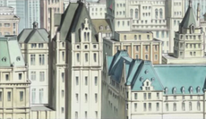
|
Big Town | Boston | Massachusetts, United States | |
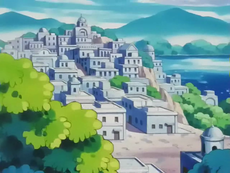
|
Whitestone | Ostuni | Apulia, Italy | The white façade of Whitestone's buildings is reminiscent of the medieval town of Ostuni. Domed buildings in the background draw inspiration from Byzantine architecture, and flat-roofed structures mirror those of the city's real-world counterpart. |
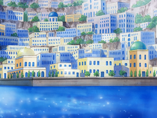
|
Sootopolis City | Santorini | Greece | Like its name suggests, Sootopolis City was created in the wake of a volcanic eruption (per Pokémon Ruby, Sapphire, and Emerald). Similarly, Santorini, Greece, was formed as a result of the Minoan eruption, which left a large caldera that filled with water and became the current bay in the center of the island of Santorini (Thera). Both cities boast landscapes dotted with vivid blue domed roofs. |
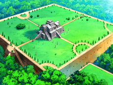
|
Solaceon Ruins | Ziggurat of Ur | Dhi Qar Governorate, Iraq | |

|
Area 28 | Area 51 | Nevada, United States | |

|
Odyssey Village | Circuit de Nevers Magny-Cours | Bourgogne-Franche-Comté, France | |
|
Kalos Canyon | Grand Canyon | Arizona, United States | |
|
Fleurrh City showcase theater | Metz and the Pompidou | Grand Est, France | The modernist and undulating design of the theater could be based on that of the Centre Pompidou-Metz, which also operates as a theater and show room. |
|
Gloire City | Menthon-Saint-Bernard | Auvergne-Rhône-Alpes, France | A coastal city located on Lake Annecy, famous for its medieval Château perched above on a 660-foot-tall rock. |
In the movie
| Movie | Pokémon world | Inspiration | Notes | ||
|---|---|---|---|---|---|
| Movie 5 | 
|
Alto Mare | Venice | Italy | Venice's canals were likely an inspiration for the canals of Alto Mare. |
| Movie 6 | 
|
Forina | Wulingyuan | Hunan, China | Wulingyuan is famed for its karst formation of quartzite sandstone pillars. Along with its ravines and gorges, the site also features a lush forest, several caves, natural bridges, and waterfalls. |
| Movie 7 | 
|
LaRousse City | Vancouver | British Columbia, Canada | Vancouver is the city with the best quality of life in Canada and like the movie, it is a very ecological city with many scientific facilities. |
| Movie 8 | 
|
Cameran Palace | Neuschwanstein Castle | Bavaria, Germany | |
| Movie 9 | 
|
Samiya | Atlantis | ||
| Movie 10 | 
|
Alamos Town | Barcelona | Catalonia, Spain | The Space-Time Towers are based on the uncompleted church of Sagrada Familia. |
| Movie 11 | 
|
Ten'i Village | Geiranger | Sunnmøre, Norway | A village that was nearly destroyed by a glacier. It is based on a town in Norway, which is threatened by the possibility of the mountain Åkerneset eroding into the fjord, causing a landslide-induced tsunami. |
| Movie 12 | 
|
Michina Town | Meteora | Thessaly, Greece | Its landscape, which is filled with towering rock formations, resembles Meteora. Also, the architecture of the temples resembles that of ancient Greek temples. |
| Movie 13 | 
|
Crown City | Amsterdam | The Netherlands | Its modern buildings are based on the many new buildings in parts of Amsterdam, and the Pokémon Baccer stadium is based on the Arena, the city's local football stadium. |
| Movie 14 | 
|
Eindoak Town | Gourdon, Tourrettes-sur-Loup and Mont Saint-Michel | France | |
| Movie 15 | 
|
Roshan City | Shinjuku, Shinagawa, and Tennouzu Isle | Tokyo, Japan | The Roshan tower is inspired by the Tokyo Skytree. |
| Movie 16 | 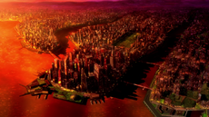
|
New Tork City | New York City | New York, United States | A giant sprawling city with many skyscrapers, a large park in the middle of the city resembling Central Park, and a similar name. New Tork City as seen from above also resembles New York City's shape. |
| Movie 17 | 
|
Avignon Town | Avignon and Quebec City | France and Canada | A city in the south of France. The castle of Avignon Town, however, is based on the Château Frontenac, a large hotel that overlooks Quebec City much like Avignon Town's castle overlooks the town. |
| Movie 17 | 
|
Orsay City | Toronto | Ontario, Canada | A city in southern Ontario famous for its port and city skylines. Like Toronto, Orsay City has a large port as well. The large mall in the city is based on the Toronto Eaton Centre, a large mall in the center of city. |
| Movie 17 | 
|
Diamond Domain | Naica crystal cave | Chihuahua, Mexico | Colossal cave of several white crystals of Selenite in Chihuahua, and many of them are the largest in the whole world. |
| Movie 17 | 
|
Allearth Forest | Niagara Falls | Canada and United States | Like several elements of the movie based in Canada, the design of the waterfalls is quite similar to the Niagara Falls which are recognizable as vertical falls and two large walls of water. |
| Movie 18 | 
|
Dahara City | Dubai and Abu Dhabi | United Arab Emirates | Dubai is located within the Arabian Desert and houses some of the world's tallest skyscrapers. The highest skyscraper is based on the Burj Khalifa. |
| Movie 19 | 
|
Azoth Kingdom | Carcassonne | Occitanie, France | Occitanie is an ancient city famous for being the meeting point between the Mediterranean and the towns of the Massif Central (the inspiration for the Nebel Plateau). It is also recognizable by its enormous walls of the citadel. |
| Movie 19 | 
|
Nebel Plateau | Massif Central and Chaîne des Puys | France | This area is similar to the Auvergne volcanoes in the Massif Central, which is a highland region containing large mountain ranges and vast plateaus full of greenery and rich biodiversity. |
| Movie 21 | 
|
Fula City | San Francisco and Los Angeles | California, United States | The eternal flame complex is reminiscent of the Los Angeles Memorial Coliseum, while Fula City's carnival pier is similar to the Santa Monica Pier, both located in the state of California. |
Real-world locations mentioned

- Prior to Pokémon: Let's Go, Pikachu! and Let's Go, Eevee!, Lt. Surge was known as "The Lightning American!". In Pokémon FireRed and LeafGreen, Pokémon Journal entries state that he "is rumored to have been a pilot while home in America."
- Game Freak's offices are present in the Celadon Condominiums, the equivalent location of their former real-world office in Carrot Tower. Likewise, they have a building in Castelia City, and are found on 22F, the same floor that their former offices were on in Carrot Tower.
- In the Generation I games and Pokémon FireRed and LeafGreen, Scientist Taylor in the Silph Co. building mentions an international branch of Silph Co. In English, he states that the Tiksi branch of the company is "in Russian no-man's-land". In the Japanese version, he states that the Ponaya Tunguska (Japanese: ポナヤツングスカ) branch is located "deep in Russia". Ponaya Tunguska appears to be a shortened form of the transliterated name of Podkamennaya Tunguska in Japanese (ポドカメンナヤツングースカ).
- Mew was originally discovered in the jungles of the South American country Guyana. This is mentioned in logs inside of Cinnabar Island's Pokémon Mansion.
- In Gold, Silver, Crystal, HeartGold, and SoulSilver, Webster, the guard in the gate north of Goldenrod City, will give the player a Spearow holding mail to deliver. The Spearow is nicknamed Kenya, the name of a country in Africa.
- In the original Japanese version of FireRed and LeafGreen, Blaine refers to Kyoto.
- Upon defeating Fisherman Bronson in the Sinnoh Battle Tower, he will say, "Why the emperor of fishing? It's an ancient Chinese legend...".
- A Guitarist that can be battled in Generation IV's Battle Frontier mentions that his guitar is actually a Japanese instrument.
- Among the exhibits of the Nacrene museum, there is an African mask, referring to a place in the real world, in addition to being different from other exhibitions, which are related to the history of the Pokémon.
- Articuno, Beartic, Arctozolt, and Arctovish's names are derived from a real-world location, the Arctic.
- Arcanine's Pokémon Yellow, Stadium, Gold, FireRed, and HeartGold Pokédex entries state that it is mentioned in Chinese legends.
- Parasect's Stadium and FireRed Pokédex entries mention that its spores are used in medicine in China.
- Ponyta's Stadium Pokédex entry mentions that it can clear the Eiffel Tower (Tokyo Tower in the original Japanese version) in one leap, and its FireRed entry says that it can clear Ayers Rock in one leap.
- Poliwrath's Gold, Ruby, Sapphire, Emerald, Diamond, Pearl, Platinum, HeartGold, Black, White, Black 2, White 2 and X Pokédex entries mention its ability to swim the Pacific Ocean. Also, the direction of a Poliwrath's spirals depends on its geographical location. In Omega Ruby and Alpha Sapphire, it instead refers to "the ocean".
- Xatu's Silver, FireRed, and SoulSilver Pokédex entries mention that South Americans say that it can see both the future and past.
- Delibird's Ruby, Sapphire, and Emerald Pokédex entries explain that a Delibird helped a famous explorer reach the top of Mt. Everest. In Omega Ruby and Alpha Sapphire, it instead refers to "world's highest mountain," which is what Mt. Everest is to Earth.
- Regice's Emerald Pokédex entry mentions Antarctic ice.
- Galarian Meowth are implied to have been raised by Vikings in ancient times, and share many similarities with them.
- In School of Hard Knocks, Misty fantasizes about Paris and the Eiffel Tower.
- In The Ninja Poké-Showdown, James says that the Fuchsia Gym looks like a Japanese restaurant.
- In the English dub of The March of the Exeggutor Squad, Melvin says he wanted to make it to Las Vegas. In the Japanese version, he said that he wanted to make it to Broadway.
- In The Evolution Solution, Meowth says, "Keep digging till you hit China!" to Jessie and James, who were digging for clam shells.
- In the William Shakespeare-inspired episode Wherefore Art Thou, Pokémon?, Misty described the town as like being in "merry old England".
- In Mewtwo Strikes Back, Team Rocket are disguised as Vikings. In the English dub, Brock says that he didn't know that Vikings still existed and Ash replies that they "mostly live in Minnesota". This is a reference to the Minnesota Vikings, a football team in the area.
- In the Swedish dub of the movie, Ash says that they come from Norway, a reference to the Norse Vikings who lived from the 8th to the 11th century.
- In the Danish dub of the movie, Ash tells Brock that the Vikings are mostly on trips in Sweden, again referring to the Norse Vikings, but may also refer to Vikingarna, a Swedish dansband.
- In the Finnish dub of the movie, Ash quips that Vikings still live in the Sipoo archipelago, referring to the fact that Sipoo was at the time mostly inhabited by Swedish-speaking Finns (another reference to Norse Vikings).
- At the end of Mewtwo Returns, Mewtwo is shown overlooking a "faraway city" that greatly resembles New York City. Buildings similar to the Chrysler Building and the MetLife Building are visible in the distance.
- In Pokémon Heroes: Latios & Latias, Misty makes a direct reference to the Earth, saying, "The Earth is so pretty." However, she may be referring to the landscape rather than the literal planet.
- In Can't Beat the Heat, Ash's Charizard uses Seismic Toss. Normally, a cloudy globe can be seen, but this time the Pacific Ocean and Australia are prominent. This also happens in Volcanic Panic and the introduction to Mewtwo Strikes Back.
- In the English dub of The Scheme Team, Jessie talks about Antarctica, the place where their next assignment is located.
- In Pasta La Vista!, an ad in May's food guidebook mentions "Chinese noodles".
- A map of the Pokémon world seen in The Bloom Is On Axew! centered on Unova features several landmasses resembling Europe and Scandinavia, with some of them either being rotated or flipped.
- In the Hindi dub of Oshawott's Lost Scalchop!, while Ash's Oshawott was perfecting Aqua Jet, Cilan states "जाना था जापान पर पहुंच गए चाइना" (lit. Jānā thā Japan, par pahunch gaye China), which refers to the real-world countries of Japan and China. The phrase itself can be interpreted roughly as "The aim and the result were different".
- In Movie Time! Zorua in "The Legend of the Pokémon Knight"!, the Eiffel Tower and the Arc de Triomphe were seen on a movie poster.
- In the Hindi dub of Mega Revelations! , Meowth says "हम सब जानते हैं कश्मीर से कन्याकुमारी तक" (lit. Ham sab jānte hain, Kashmīr se Kanyākumāri tak). This is a common Indian saying, roughly translating to "Our knowledge is supreme", which refers to the Indian subcontinent's northernmost region, Kashmir, and its southernmost city, Kanyakumari.
- Starting with the sixteenth movie, each Pokémon movie features a recurring globe texture in the intro used to represent the Pokémon world (as opposed to simply featuring randomly-shaped, nondescript landmasses below the clouds): the globe texture features altered landmasses such as one resembling Africa but featuring only the Sahara Desert and the southern half being missing, a large island to the northwest of the Sahara-like landmass, the Arabian Peninsula missing several large chunks, a landmass resembling Australia but rotated 90 degrees clockwise in the middle of a body of water resembling the Indian Ocean, and the northeastern portion of Russia being missing. However, other parts of the globe remain virtually unchanged, like those resembling most of Europe, the Indian subcontinent, Central and Southeast Asia, and Papua New Guinea.
- In Mega Evolution Special IV, a holographic globe can be seen inside Lysandre Labs. The globe features continents similar to the real Earth, implying that the planet's continents may probably look very similar to that of the real Earth, and that all of the known regions in the Pokémon world may actually in fact be smaller parts of a much larger landmass.
- In the TCG Secret Mission (Gym Heroes 118) card, the map in the background shows German occupied Poland during World War II: Warsaw is located right above Raichu's right ear, Białystok and Brest-Litowsk behind Lt. Surge, and the Silesian Border between Andreashütte and Festenberg right below Raichu's binoculars. The rivers Weichsel, Narew and Bug are also depicted.
- In the TCG Lucky Stadium (Neo Destiny 100) card, there is a promotional New York City print with a Pichu and a Pikachu flying on a Charizard in New York City, with the Empire State Building visible in the background.
- In the planetarium special Celestial Debris, a map of the Pokémon world can be seen on a computer monitor. The map texture looks very similar to the one used to represent the planet in later Pokémon films, with three landmasses resembling North America, Europe, and eastern Russia all appearing upside down.
Real-world people and cultures mentioned
- Hitmonlee and Hitmonchan are explicitly named after martial artists Bruce Lee and Jackie Chan, respectively. In other languages where their names are different, those names are likewise derived from real people.
- Snorlax's Japanese name Kabigon is the nickname of Game Freak programmer Kōji Nishino.[8] This is referenced in Black 2 and White 2, in which Nishino appears as a battleable NPC and his highest-leveled Pokémon is Snorlax.
- The core series games have featured staff members of Game Freak that typically reward the player for completing the National Pokédex, or occasionally through alternative methods. Shigeki Morimoto can be battled in the Generation V, VII, and VIII games; in Ultra Sun and Ultra Moon, he is fought in a Double Battle that also features director Kazumasa Iwao.
- In Pokémon Shipwreck, Brock directly refers to the tale of Noah who sent a dove to find dry land after a great flood, according to most Abrahamic religions.
- The Japanese version of the song Team Rocket Forever includes the lines 「ムサシ!/コジロウ!/関門海峡/門司/下関」"Musashi!/Kojirō!/Kanmon Straits.../Moji.../Shimonoseki...", referencing the famous duel that Miyamoto Musashi and Sasaki Kojirō (the name basis for Jessie and James's Japanese names, Musashi and Kojirō) fought on an island in the Kanmon Straits, which is located between Moji and Shimonoseki.
- The Japanese holiday Hinamatsuri (means Doll Festival, but sometimes referred to as Girls' Day) is featured in Princess vs. Princess (dubbed as the Princess Festival).
- The Japanese holiday Children's Day (Kodomo no Hi) is featured in The Purr-fect Hero (dubbed as Kids Day).
- Christmas is mentioned several times in the anime and manga. Santa Claus is a recurring character in the Pokémon anime who first appeared in Holiday Hi-Jynx. In the dub, Santa's home is called the North Pole.
- In The Art of Pokémon, James mentions the presence of Picasso and Rembrandt's paintings at his home.
- In Celebi: The Voice of the Forest, Meowth asks if they saw the Iron-Masked Marauder in a Mexican wrestling movie.
- In A Bite to Remember, Jessie says that Albert Einstein created the light bulb. Max corrects her, saying that Thomas Edison was the creator.
- NPCs in the core series games are regularly named after real-world people.
- In the Generation IV Battle Frontier, one of the potential NPC opponents is Guitarist Iggy, a reference to Iggy Pop.
- Johto Route 35, Connecting Cave, Hau'oli Cemetery, and Viridian Forest (in Pokémon: Let's Go, Pikachu! and Let's Go, Eevee!) each contain a Trainer whose Japanese name is Ikue (in the latter two cases, this name was preserved in other languages as well) and who uses a Pikachu. Ikue Ohtani is the voice actress for Ash's Pikachu.
- Alola Route 5 contains a Double Battle against trainers named Isa and Nico, named in honor of the daughters of Eric Medalle, a Pokémon creative director who was killed in an accident during the time Pokémon Sun and Moon were in development.[9]
- In Pokémon Sword and Shield, an Artist NPC named Kapoor can trade with the player, a reference to British artist Anish Kapoor.
- In Pokémon Crystal, several Trainers in the Battle Tower are references to people involved in the creation of the game.[10]
- Guitarist Masuda is a reference to Junichi Masuda, Crystal's music director.
- Bug Catcher Tajiri is a reference to Pokémon's creator, Satoshi Tajiri, and his childhood fixation with bug catching.
- Scientist Mori is a reference to Akito Mori, who is listed under "special thanks" in Crystal.
- Teacher Kawakami is a reference to Naoko Kawakami, who is listed under "special thanks" in Crystal.
- In Pokémon HeartGold and SoulSilver, a Team Rocket Grunt mentions the hula dance to a Kimono Girl while in the Kimono Dance Theater.
- In Pokémon Black and White, six of the Seven Sages quote proverbs from several Chinese philosophers.
- Zinzolin quotes a proverb from Mencius and a line from Tao Te Ching at N's Castle.
- Gorm quotes a proverb from Sun Tzu's The Art of War in Pinwheel Forest, and a line from both The Analects and Huainanzi at N's Castle.
- Bronius quotes another line from Tao Te Ching at N's Castle.
- Giallo quotes another line from Mencius at N's Castle.
- In the Japanese version, Ryoku quotes a line from Zhuangzi at N's Castle. In both versions, he also quotes a proverb by Song Dynasty philosopher Hu Yin at N's Castle.
- Rood quotes another proverb from the Analects and made a reference to a Chinese idiom at N's Castle.
- In Black, White, Black 2, and White 2, the woman in Mistralton City who normally gives a Heart Scale in exchange for ten Sweet Hearts will trade a Heart Scale for only five Sweet Hearts on Valentine's Day and White Day.
- Archeops's name is possibly derived from Cheops, the Greek name for Egyptian pharaoh Khufu.
Other references to the real world
- In all of the core series games and some side series games, there is a Nintendo gaming console in the player's bedroom. This is a reference to the real-world gaming company that owns the franchise.
- An old man at the Pewter Museum of Science says that the first manned flight to the moon was in 1969, same as in the real world.
- Raichu and Gastly's FireRed Pokédex entries mention both Pokémon being able to easily knock out an Indian Elephant, an actual animal. However, in Pokémon Legends: Arceus, Raichu's entry instead mentions Copperajah.
- The Arceus event that takes place in Pokémon HeartGold and SoulSilver includes real life pictures in the game.
- Porygon's Sun, Ultra Sun and Ultra Moon Pokédex entries mentions it was created "20 years ago", referencing the release of Pocket Monsters Red and Green.
- In Beheeyem, Duosion, and the Dream Thief!, a painting within the resort created by Beheeyem bears a striking resemblance to Relativity by M. C. Escher.
- One of the hotels Ash and his group tried to stay at and ultimately failed to do so in the episode Riddle Me This! featured a painting of a tiger near grass, mirroring a similar painting found at Azuchi Castle.
- The nameless movie May describes in Lights, Camerupt, Action! is a reference to the movie Titanic.
- In Dawn's flashback in Yes In Dee Dee, It's Dawn, a teacher tells her students a tale about Buneary and Turtwig, which is similar to "The Tortoise and the Hare".
- In I Choose You!, Ash dreams about being in an alternate reality where no Pokémon exist and children attend regular school.
- Multiple references to the geographical relations between the real world locations the in-game regions are based on have been made throughout the games; for example, a Swimmer on Galar Route 9 says people have successfully swum between Kalos and Galar.
References
- ↑ UN Atlas of the Oceans
- ↑ Pokémon Sun and Moon Japanese official site
- ↑ Interview with Junichi Masuda and Shigeru Ohmori on the official Pokémon website
- ↑ Tweet regarding Isle of Armor and Crown Tundra's inspiration
- ↑ 5.0 5.1 5.2 5.3 5.4 5.5 5.6 5.7 5.8 Galar Tour Brochure
- ↑ Exclusive Pokémon Sword And Shield Concept Art Gallery
- ↑ http://www.nintendo.co.jp/nom/0311/soft/interv01.html
- ↑ Falling tree kills Pokémon designer and Detroit native Eric Medalle - Detroit Free Press
- ↑ iimarck.us - Battle Tower In‐Jokes

